“Okay guys, listen up. You have 30 minutes till you walk out the door. Here’s the mission scenario.”
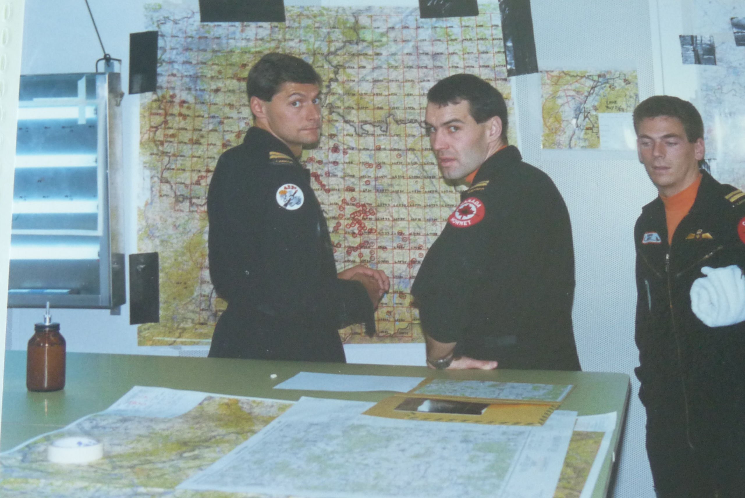
Tom Sweeney, our Tactical Evaluator, set down the mission folder on the planning table in the bunker. My CF-18 Hornet squadron, 433 Escadron Tactique d’Appui de Combat (ETAC, a French-language unit in Canada’s Air Force), had deployed to Lahr, West Germany, to fly with our brethren who were stationed in theater, 75 km (45 miles) up the Autobahn in Baden-Soellingen.
Tom and I had gotten our pilots’ wings together eight years prior, but he had gone to fly CF-104 Starfighters in Germany while I was assigned to train pilots as an instructor in Moose Jaw, Saskatchewan. Finally, I was getting a chance to prove I could qualify as a combat-ready flight lead with NATO forces in Germany, almost a decade later.
I’d already qualified as a flight lead with NORAD, flying air defense missions in Canada from our home base in Bagotville, Quebec, and other deployed bases. Our squadron’s role as a ‘rapid reactor’ to reinforce NATO in wartime required us to be qualified in the European theater as well. Europe had its own entirely different sets of rules, and all of us had been to Germany to fly with Canadian squadrons based there to learn the ropes.
Now, as part of a squadron deployment, was essentially the final exam that would cap off our upgrade training. Today, Tom (“Sween”) was flying as number two, evaluating our Section lead, Richard “Dog” Duguay, myself as number three, an element lead, and another pilot as number four, my wingman. The flight test scenario was called a Tactical Evaluation, or ‘Tac Eval.’
NATO had a standard for the minimum time allowed to plan a ground attack mission. Naturally, these Tac Eval missions were predicated on doing things in the absolute minimum time, pushing us to the limit of what could be expected of us. Today we had about 30 minutes to plan, brief, and walk out the door of the bunker fully dressed for flight.
Sween was flying as number two in his role as an evaluator, and he was watching both Dog and me during the planning, flight, and debrief. The goal was for both of us to be certified as flight leads in Europe, and for number four to be evaluated as a ‘winger.’
Today’s scenario involved an attack on a NATO SAM (surface-to-air missile) site north of Frankfurt. This was a real missile site, which we were pretending was a Soviet installation for the purposes of the mission. The first order of business was to work backward from our assigned time on target (TOT) to see when we needed to take off, when to start engines, and how much time we had to plan and brief the mission.
Dog and I conferred over the target folder, quickly studying the pictures and 1:50,000 scale topographical maps. We devised which weapons to use, which axis to attack from, and how to egress without being shot down. All four of us, including Tom as our number two, were assigned tasks according to the Standard Operating Procedures (SOPs). We delved into the Joint Munitions Employment Manuals (JMEMs) to determine the number of weapons to be used to inflict maximum damage, while avoiding defenses and not being damaged by the exploding targets as we overflew them. The wingmen dug out the appropriate 1:500,000 scale maps and busied themselves drawing lines and restrictions on them. Even at speeds of seven to almost nine miles per minute, it would still take us almost half an hour to reach the target.
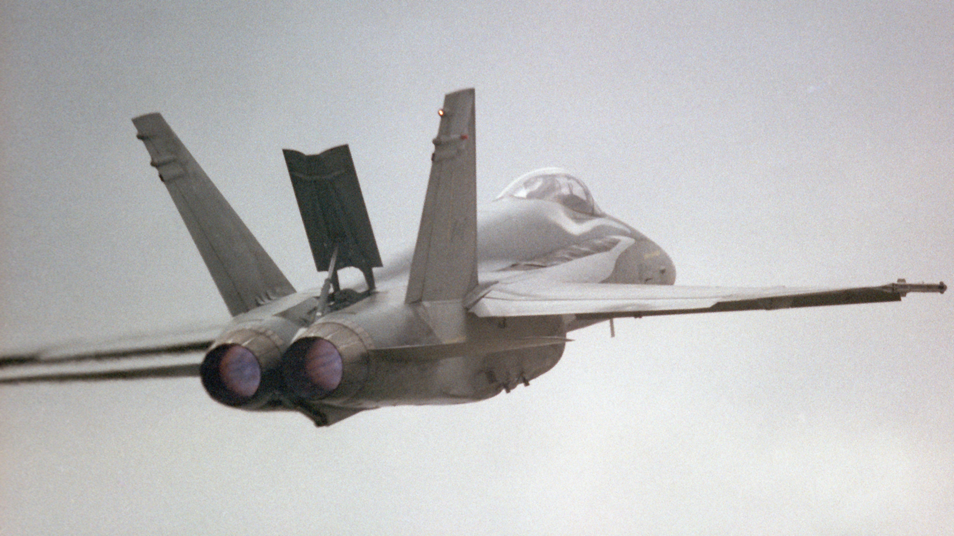
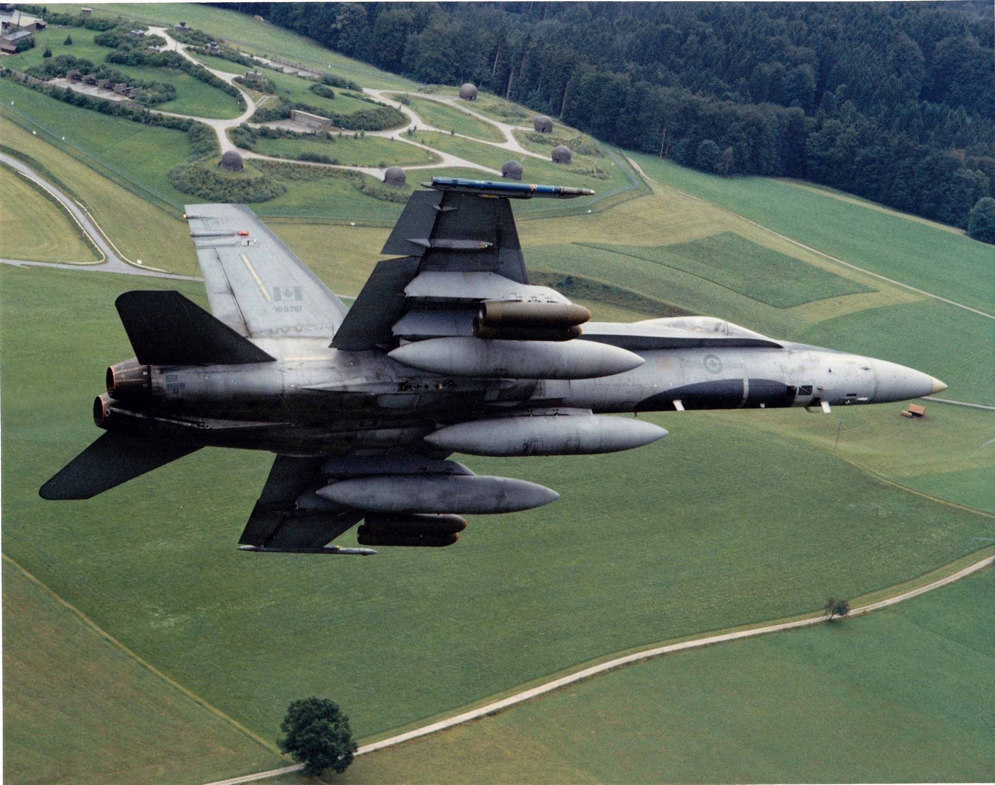
A flurry of planning ensued. We ended up with a plan to fly CRV-7 rocket attacks, each of us carrying four pods of 19 rockets (a total of 76 rockets per aircraft). These rockets could be fired from 9,000 to 12,000 feet away, and would hit the target supersonic. They had warheads that would penetrate and then fragment, destroying bunkers, antennae, and buildings, and killing any personnel on site. Of course, we didn’t actually carry and fire the rockets. We were going to use the CF-18’s onboard software to simulate the aiming and firing of the rocket pods.
With eight minutes until we had to walk out of the planning area to get dressed in our flying gear, it was almost briefing time. “Three minutes. Make copies and be ready” announced Dog. The wingers busied themselves with the color photocopier, making three copies of the master maps. Those maps were meticulously drawn using standard operating procedures colors and symbols. Waypoint numbers in blue, with blue circles. Distances in green, on the left sides of the track lines. Timings in black, on the right side of the tracks. Speed changes in red. Headings and track lines in black. There were mission data cards with all the waypoints, frequencies, carriage/release/jettison data and limiting speeds for the weapons and external fuel tanks. Chaff, flare, and jammer usage as well as code words and callsigns were also included.
While the wingers made the copies, Dog and I huddled again to share the elements of what each of us had been doing. “Time Hack. In 33 seconds, it will be 13:17 Zulu.” The last maps were passed around by the wingmen to the leads as we all organized our little patches on the planning table with the sheets of paper, and synchronized our watches. Mine was within a second, so I didn’t bother changing it.
Dog went through a ‘minimum time’ briefing format. Target information and plan was first, followed by threats and how to avoid them. Contingencies were covered, as were what to do if we were intercepted by other aircraft en route. Weather was a concern today, because there was some fog with limited visibility, and some rain showers, especially in the target area. Cloud ceilings were low, on the limit for what we could accept with Europe’s peacetime flying rules, but Dog had decided we were going to launch anyway. I could see Tom taking notes that obviously were passing some sort of judgment on those decisions. I had no idea if he was approving or disapproving, but I had no time nor did I have any capacity to fret about that.
The briefing ended with the typical “Everything else is SOP” directive. Our fighter wing in Europe, known as ‘4 Wing’ had a thick publication with all of their SOPs. They covered all aspects of flying operations, such as ground operations, radio calls required, terminology to be used, radar scan responsibilities by formation members, air-to-air (A/A) tactical air navigation (TACAN) frequencies, reaction to aerial or surface threats, radar sorting and shooting, rules of engagement (i.e. when to shoot or not to shoot), and many, many other items. In short, briefing items that would have taken up 20 to 30 minutes when we were going through basic fighter pilot training had been completely covered in that one phrase.
Part of what we were being evaluated on was our knowledge and application of SOPs. The exercise scenario was designed explicitly to force formation members to apply and adapt those SOPs to changing circumstances.
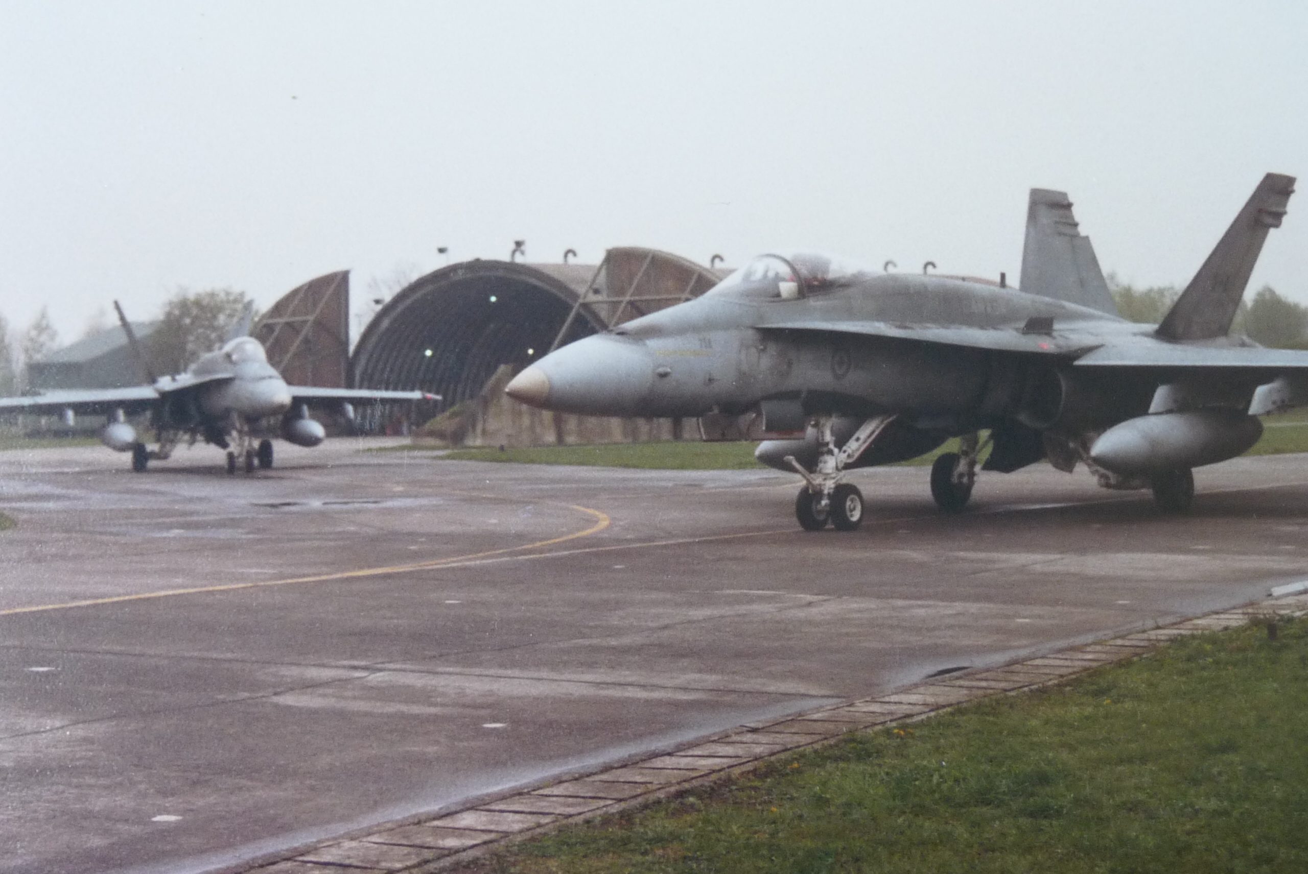
By now, the mundane details of getting dressed, signing out, and walking to the hardened aircraft shelters to start our aircraft were old hat. I was mostly preoccupied with visualizing the routing, my actions, and how to make an effective attack.

The route to the target area started out fairly simple. We were to pass just to the east of Frankfurt at low altitude, parallel to the East German border, northbound. After passing the airspace around one of Europe’s busiest civilian airfields, we’d swing northwest from Frankfurt to the target area. The egress was along the same path.
One particularity of the area east of Frankfurt was the proximity to Warsaw Pact airspace. We were flying underneath what was then a ‘buffer zone’ between East and West. At low altitude, there were no constraints – the buffer zone existed only 1,500 feet above ground. Above that in the buffer zone, there were special procedures for military aircraft, including transponder operation, flight paths, etc. In short, the idea was to avoid having a high-speed military aircraft flying toward East Germany, making Air Defense forces on the Soviet side nervous and thinking they were being attacked by NATO. Today’s weather conditions made the routing under the buffer zone unavoidable.

We launched from the northbound runway, flying a carefully designed path that our own base’s air defenses would recognize. Groundspeeds, turning points, transponders, and other things were used to appear friendly to the twitchy fingers of friendly missile and gun batteries.
En route, out of the base’s air defense zone, we settled into an offset ‘card’ formation, accelerating to 420 knots (kts) groundspeed, or about 485 mph. In this formation, lead was in front, two was offset 1.5 nautical miles to his right, and I was about 30 seconds (3.5 to four miles) behind them. I offset my flight path a bit to the left of my lead’s, and my winger (number four) was off to my right side. For now, the visibility was looking reasonable, but not great. I knew that it would be dropping as we progressed further north.
Sween had us squawking the ‘please attack me’ transponder code for NATO peacetime practice. Sure enough, a couple of what turned out to be F-15s from the ‘American sector’ (Bitburg, Ramstein, and other USAF bases to the northwest of ours) came at us from our 10 o’clock, high. They were operating above the lowest cloud layer, so we never saw them, but lead and two prosecuted an attack on them, scoring simulated kills and avoiding being shot themselves (or so we liked to think).
The short engagement had slightly delayed us, so Lead called for us to ‘push it up to 510’ a bit earlier than planned. That meant we were traveling at 500 feet above ground, covering eight and a half nautical miles per minute (almost 600 mph). We were still well within our TOT window, but Dog wanted to be as precise as possible. Flying east of Frankfurt now, the cloud (ceiling) was getting gradually lower, and tendrils of cloud and fog were touching some of the rolling terrain in the area. Following SOP, we collapsed into an Arrow formation to weave our way through the gaps in the terrain, maintaining our minimum altitude above ground, and staying fairly close to our planned track. Luckily, given the poor weather forecast, we had already designed our route to pass through the lowest-altitude terrain in the area.
Before we knew it, we were approaching the target area. There was considerable fog caused by rain showers in the area, and visibility was marginal, and getting worse.
Lovely.
Imagine flying below low, scraggly clouds that almost touched the rolling hills, and only being able to see about 20 seconds ahead of the aircraft. The ‘pucker factor’ was rapidly increasing in all our cockpits.
I fudged my flight path a bit to the west of my planned line, where it wasn’t raining as hard, and the visibility was a bit better. I made sure my videotape was rolling to validate my weapons release on target, on time.
At about five miles from the target, I pulled my nose 45 degrees to the left, climbing to about 1,500 feet above ground. I was just skirting the base of the ragged clouds. I pulled back to the right where I could just make out the NATO missile site, hidden in the murky green forested area between two hills. I smiled as I pushed the ‘pickle’ button, registering my simulated rocket shot. I held the pickle for a full two seconds to make sure that all four pods would shoot their rockets, then hauled my aircraft into a 5-G horizontal pull, simulating chaff and flare ejection and voicing it to my tape so Sween would hear that I was doing it.
Phew. I was really afraid that we wouldn’t see the target, given the bad weather. Later, in the debrief, we reviewed everyone’s videotapes and saw that three out of four of us had ‘hit’ the target within 10 seconds of the planned timing. The only person who missed the target (he didn’t see it in time, and had to abort his attack) was our esteemed Evaluator, Tom Sweeney.
Oops.
No, I didn’t gloat… Much! For now, though, I had no idea how it had gone. The priority was to reform the formation, and return to base. The weather was getting worse. Soon, I lost sight of lead in the murk, and he was only 3.5 miles ahead according to my air-to-air TACAN readout. I could see the blips from lead and two at the bottom of my radar screen, and I just followed my track line. Number four had closed in about one mile away, and he was barely visible in the foggy clag below the clouds.
Near a turning point, under the buffer zone, I was confronted by a wall of rain and fog. I looked to my right. Number four had disappeared from view beyond a small hill that was between our flight paths. I edged my aircraft slightly lower, but my radar altimeter (RADALT) went off. We were supposed to be at 500 feet Above Ground Level (AGL) minimum. I’d set my RADALT at 100 feet. Dang. Even at 100 feet AGL, there was no way I could get below the upcoming rain and fog. I looked ahead and up, and saw some slightly lighter areas within the strato-cumulus clouds above.
Screw it. I pulled my nose up aggressively, gaining altitude up to the minimum safe altitude for the sector, which happened to be above 1,500 AGL, solidly in the buffer zone. Frantically, I took several actions within seconds. I turned off my transponder. It would be a bad idea to announce to air traffic control and Strawbasket (NATO air defense radar) that I was flying within the buffer zone without authorization, in clouds, and at high speed (510 kts). I also slewed my radar scan to search anxiously just ahead, confirming there was no aerial traffic ahead for the next 30 miles or so. Luckily, there was normally no traffic in the buffer zone, with the exception of three corridors to and from Berlin.
I pushed my radar scan back down, and found lead and two. Still climbing, now through 5,000 feet, I was nowhere close to coming out of cloud.
Crap.
I climbed higher, plugging in the afterburners briefly, and broke out on top of the fluffy clouds at almost 18,000 feet. I looked at my moving map. Wow, I was very close to the Eastern German border. I turned a bit to the right, to ensure I was not converging on it, and double-checked that my transponder was indeed off. My radar warning receiver was silent, meaning that no attack radars were tracking me on the Soviet side of the border.
I confirmed where the rest of my formation was, below the cloud, with my radar. Not bad. They were now seven miles ahead, because I’d lost a bit of position with the rapid climb. No radio calls yet, not from within the formation, and nothing on Guard (the emergency frequency).
I was praying that there would be no ‘Brass Monkey’ call. Brass Monkey was the code for a lost NATO aircraft, heading toward East Germany. If any NATO pilot heard that, the procedure was to immediately turn Westbound and confirm one’s position. The most likely cause was being lost, and that’s why NATO radars made a call on Guard and everyone, even those who thought they were okay, were to react.
Squinting down into the clouds below, I spotted a small gap and some green terrain. Yes! I chopped my throttles to idle, and locked up lead’s aircraft with my radar. This was a no-no during a tactical flight, but there was no way I could be making a steep descent through murky, cloudy, skies, while trying to keep track of lead’s radar blip in search mode.
If Dog mentioned it, I’d beg forgiveness in the debrief.
Keeping the patch of green ground in sight, I dove steeply, spiraling down through the tiny gap in the puffy clouds, extending the speed brake and pulling G in the spiral to keep my speed subsonic. As I dropped through 2,000 feet, I went below the cloud cover, and saw that I was now only five miles behind lead. I broke the radar lock, and looked to my right for number 4. There he was, only slightly ahead. I’d been out of sight of the formation for about 90 seconds, but it had seemed like an eternity. I turned my transponder back on, and pretended everything was normal.
Looking back over my shoulder, I could see a wall of fog and rain that the formation had just emerged from. Maybe they hadn’t seen what I’d done, I hoped.
The remainder of the flight was uneventful. I said absolutely nothing about my little excursion into forbidden airspace during the debrief. At the end, after Tom gave us some good feedback about some relatively minor areas to improve, he congratulated us on our successful qualifications. He stamped and signed our log books.
For the next week, until we finished our deployment and went back to Canada, I lived in fear that someone would invite me into a supervisor’s office to be asked just what the hell I was doing in the buffer zone.
That didn’t happen.
It looked like I got away with it. I didn’t tell anyone about my buffer zone incursion for several years – it was something I was not proud of, and I was afraid of any possible repercussions. I can tell the story now, because all those air defense batteries that were poised to shoot me down if I went into East German territory are now NATO members, and friends.
Retired Major Dan McWilliams logged 3,200 hours over 20 years in the Canadian Air Force, flying the CT-114 Tutor, CF-5, T-33, and CF-18. A specialist in Electronic Warfare and software, he managed a group of engineers developing mission-critical software for the CF-18 and for CF-18 simulators. He later flew and instructed in the Challenger 604, tested full-mission simulators for military customers, managed a CF-18 mission training center, and taught at an aviation college.
Contact the editor: tyler@twz.com
Loading comments…
Comments couldn’t be loaded. Please refresh the page.