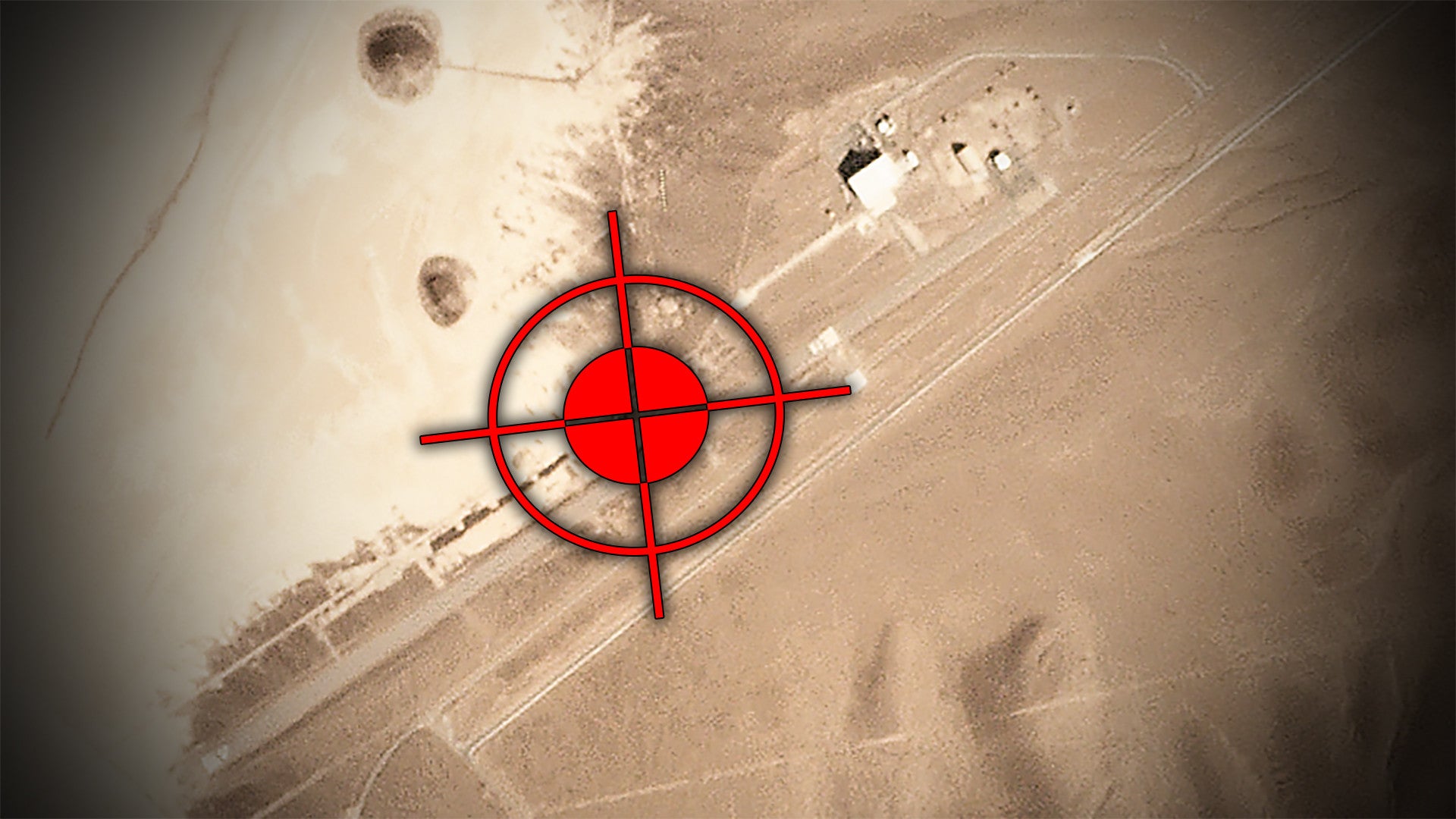
Hidden away in the desolate mountains of the Mojave desert, NASA has been operating an expansive space communications and research complex since almost the very beginning of the Cold War-era Space Race. The historic and isolated locale is also home to an unassuming airstrip that runs alongside a dry lakebed. It has long caught the eye of The War Zone as a particularly ideal location for a drone base, and, as it turns out, this once austere runway has been quietly transformed into exactly that.
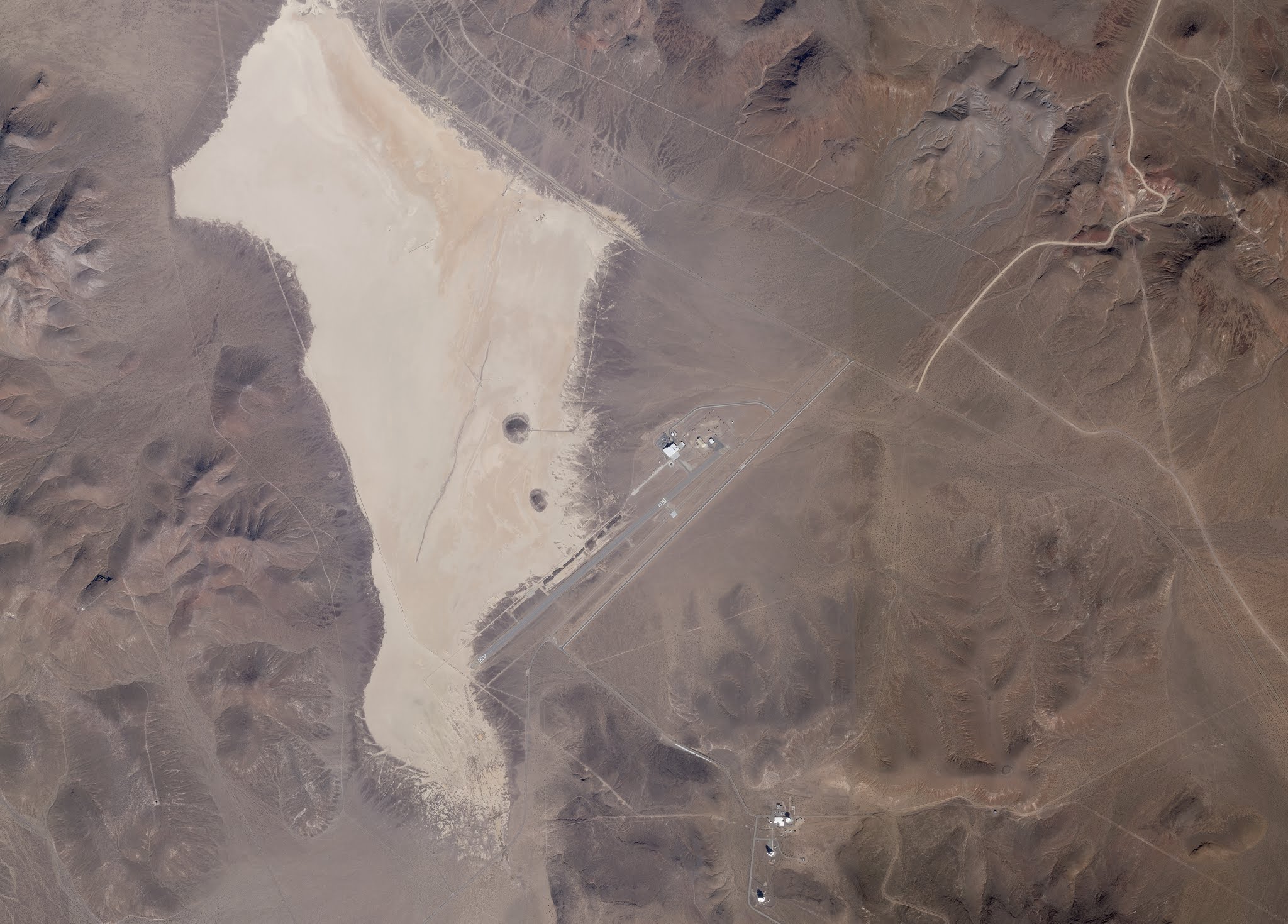
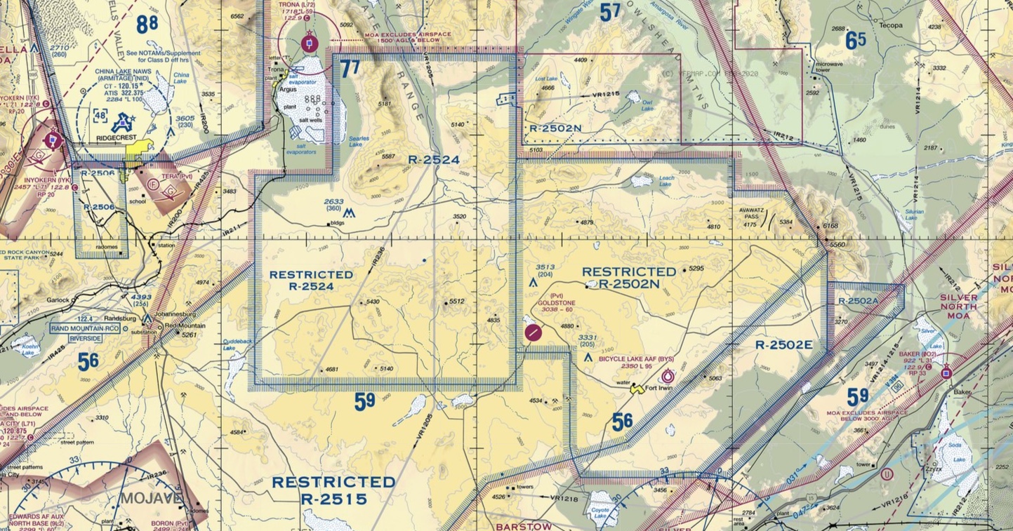
Goldstone Airport, also known by the abbreviation GTS, sits at an altitude of 3,038 feet and has a single runway that is approximately 6,000 feet long. It is situated within NASA’s Goldstone Deep Space Communications Complex (GDSCC) along Goldstone Dry Lake. The entire complex is located to the northeast of Barstow, California and the airport is approximately 13 miles northwest of the center of the U.S. Army’s Fort Irwin, which oversees the nearby National Training Center, one of the service’s premier training facilities. The GDSCC is itself within the bounds of Fort Irwin and the NTC. The area and its various facilities take their name from Goldstone, California, a gold-mining ghost town in the vicinity.
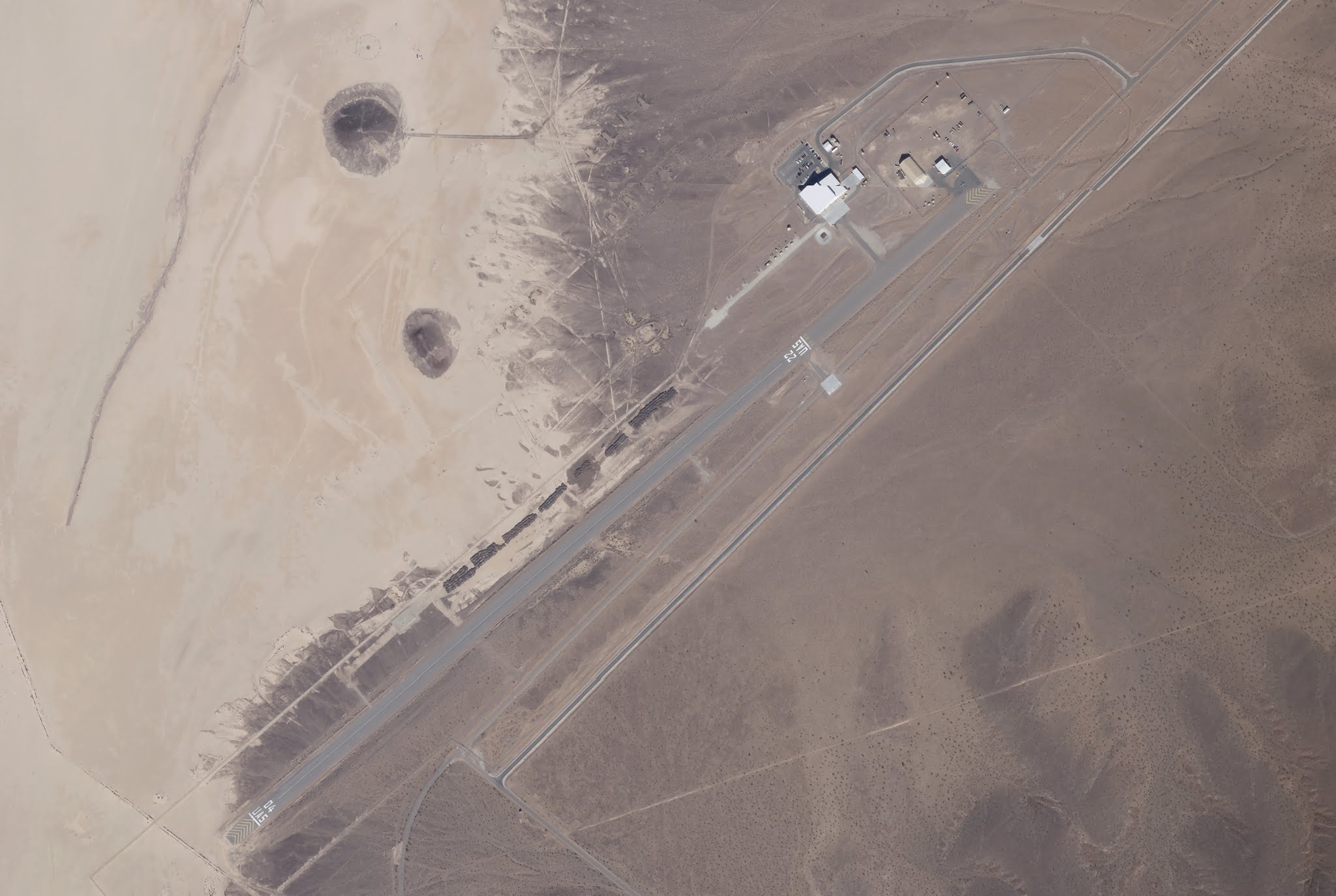
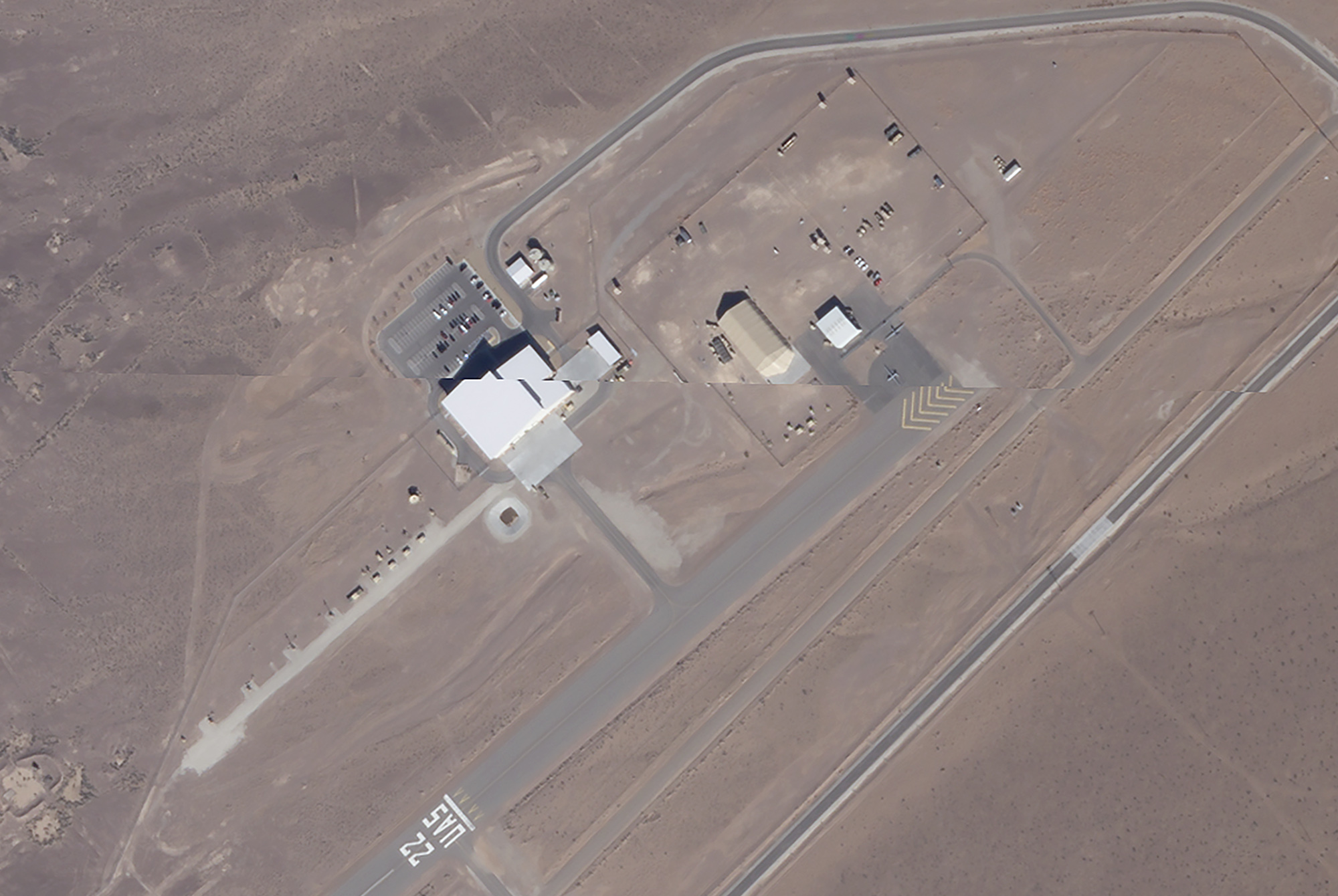
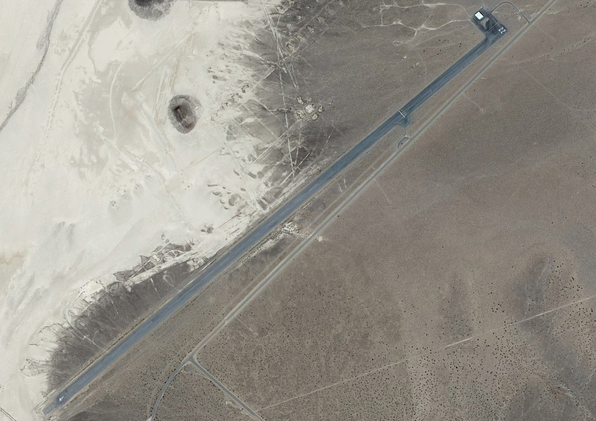
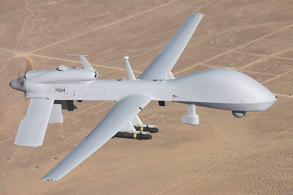
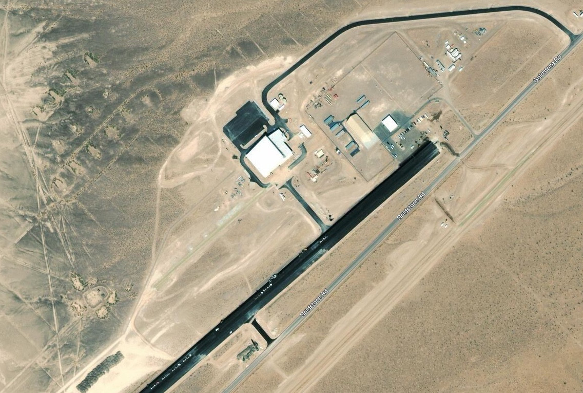
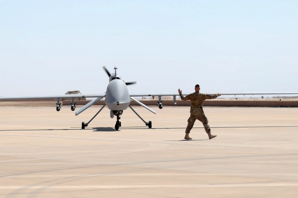
Imagery of Goldstone Airport that The War Zone obtained exclusively from Planet Labs shows that, at least as of Feb. 12, 2020, it had one large permanent hangar, as well as a separate ramp with a semi-permanent clamshell-type hangar and a single sunshade. What appears to be a pair of MQ-1C Gray Eagle drones are out in the open near the sunshade. It’s worth noting that the imagery has a minor alignment processing error, which creates a small offset discrepancy between the stitched-together satellite images that make up the scene.
This all makes good sense since, at present, the Army’s Company B, 229th Aviation Regiment, nicknamed “The Flying Tigers,” is the main unit based at Goldstone. This company is under the control of the 2916th Aviation Battalion, which is part of Fort Irwin’s 916th Support Brigade.
Company B has a fleet of approximately 12 MQ-1Cs and its primary mission is to operate those drones during training exercises at the National Training Center (NTC). The NTC, which first opened in 1980, encompasses an area covering more than 1,000 square miles and provides ample room for large and highly complex wargaming. These exercises typically take place before a large Army unit deploys overseas.
Space Race Origins
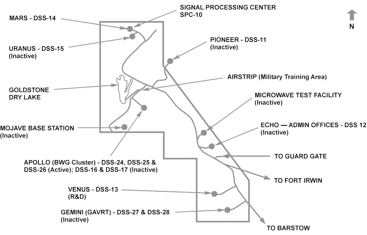
NASA’s Goldstone Deep Space Communications Complex (GDSCC) is situated within the boundaries of Fort Irwin and the National Training Center, but the drone base within its confines is a relatively new addition. The airfield had previously supported the deep space communications site’s operations.
The Army began building the first space communications antenna at Goldstone, an 85-foot wide Cassegrain type, in 1958 to support the Pioneer space probe program. The service’s Jet Propulsion Laboratory was in charge of the program. That same year, the United States created the National Aeronautics and Space Administration (NASA), which subsequently took control of the JPL and the Pioneer Deep Space Station, also known as DSS 11.
By the time DSS 11 began operations, the Space Race between the United States and the Soviet Union was in full swing. The Soviets had stunned the world in 1957 when they launched Sputnik, the first-ever man-made satellite in orbit around the Earth. The U.S. government was determined to catch up, launching the first Explorer satellite in January 1958.
Between 1958 and 1960, NASA also launched 10 Pioneer space probe missions, the bulk of which were to the Moon, though one was also sent to orbit Venus. DSS 11 provided a critical link to these probes. A second wave of launches, 9 in total, one of which was destroyed in a launch failure, occurred between 1965 and 1978. These probes studied the Sun, Jupiter, Venus, and general weather patterns in space. NASA only decommissioned DSS-11 in 1981 and stopped monitoring the remaining Pioneer probes altogether in 1992.
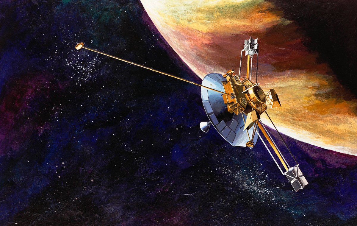
In the intervening years, DSS 11 also supported a wide array of other NASA space programs, including the Viking space probe and lander missions to Mars and Voyager deep space probe missions to Jupiter, Saturn, Uranus, and Neptune. The Viking and Voyager missions were all launched in the 1970s. The Pioneer Deep Space Station also had a role in the Apollo manned missions to the Moon.
Beyond Pioneer
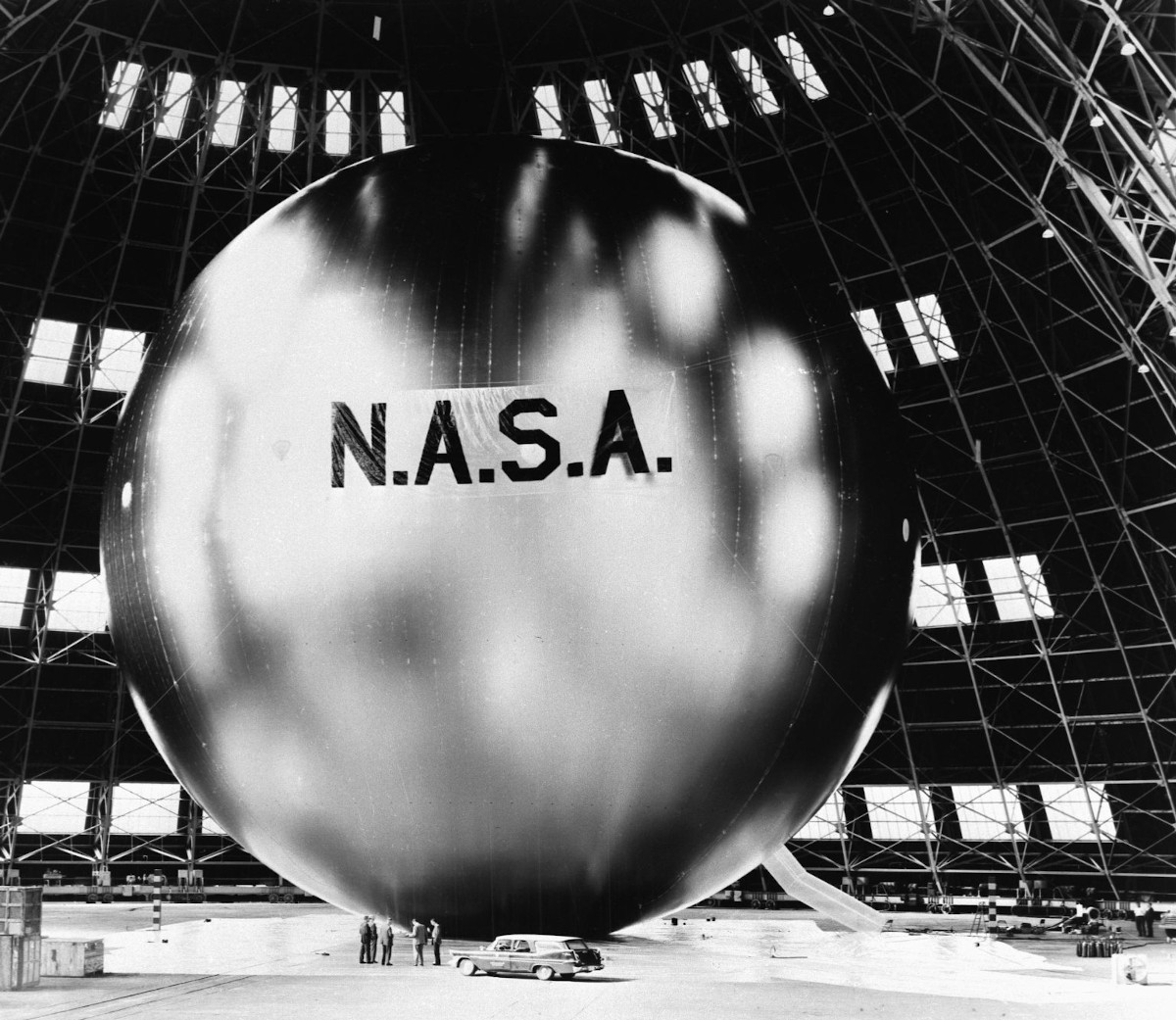
NASA operations at Goldstone also grew significantly in the decades after the construction of DSS 11 and the beginning of the Pioneer program. In 1959, the complex gained its second site, DSS 12, or Echo, which initially supported the balloon satellite communications program of the same name with another 85-foot Cassegrain antenna. The Echo antenna was also employed as a radio telescope and gave NASA its first radar imagery of Venus.
In 1962, NASA built a new 85-foot antenna at the Echo site with an hour angle-declination (HA/DEC) drive system that was better suited to supporting deep space missions. The existing antenna had an azimuth-elevation drive system intended for tracking objects closer to Earth, such as the Echo balloons. The DSS 11 antenna also had an HA/DEC drive system. As a result, workers moved the azimuth-elevation drive system-equipped antenna from DSS 12 to a new site, which became known as Venus or DSS 13.
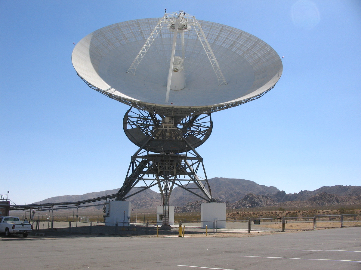
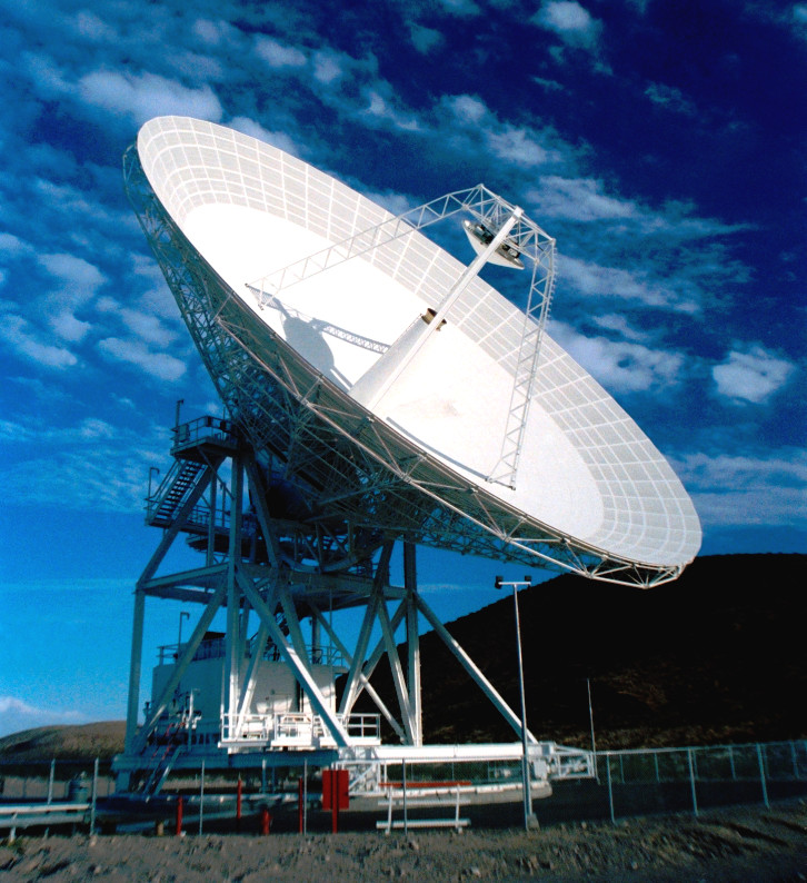
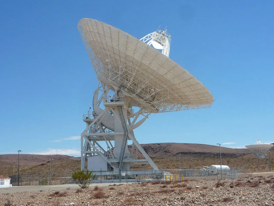
The year after the construction of the new antenna at the Echo site and the creation of the Venus site, NASA embarked on a project to build a significantly larger and more powerful antenna. Work on DSS 14, also known as Mars, with its massive antenna, nearly 230 feet wide, was finished in 1966 and immediately began supporting the Mariner missions to Mars. DSS 14 eventually became the first node in NASA’s Deep Space Network (DSN), which consists of three similar antennas, the other two of which are in Australia and Spain.
The Signal Processing Center, also known as SPC 10, was and still is collocated with DSS 14 and serves as the central data collection point for the Goldstone complex. The personnel there also remotely control all the other antennas across the facility.

The construction of DSS 16 and 17, both of which NASA built in what became known as the Apollo Valley or just Apollo, came soon after DSS 14’s completion. The Apollo antennas, the first of which was finished in 1966, were both specifically intended for the manned space missions of the same name, including the Apollo 11 mission, the first to bring humans to the surface of the Moon.
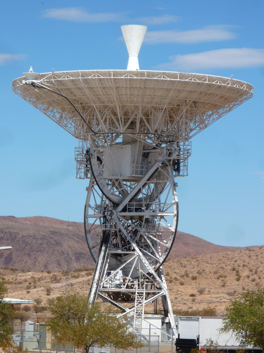
During the 1970s and 1980s, NASA continued to upgrade the various sites at Goldstone, including the conversion of the existing 85-foot antennas to 111.5-foot designs. It also built a new 111.5-foot antenna with an azimuth-elevation drive system, known as DSS 15 or Uranus, within the complex in 1984. DSS 16 also began supporting the Space Shuttle program in the 1980s.
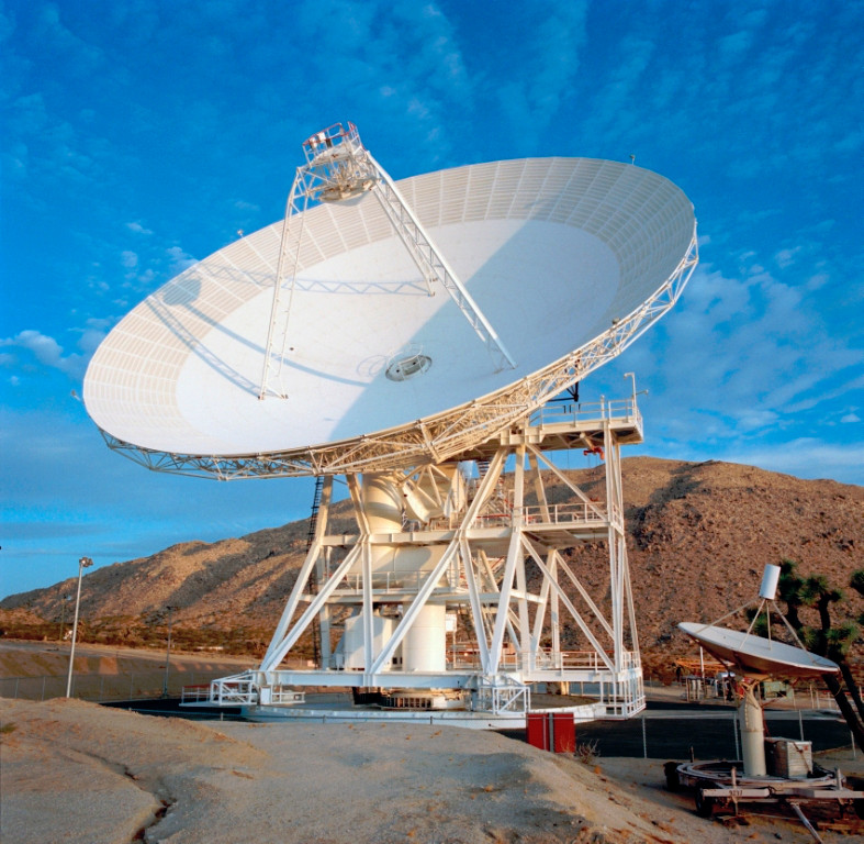
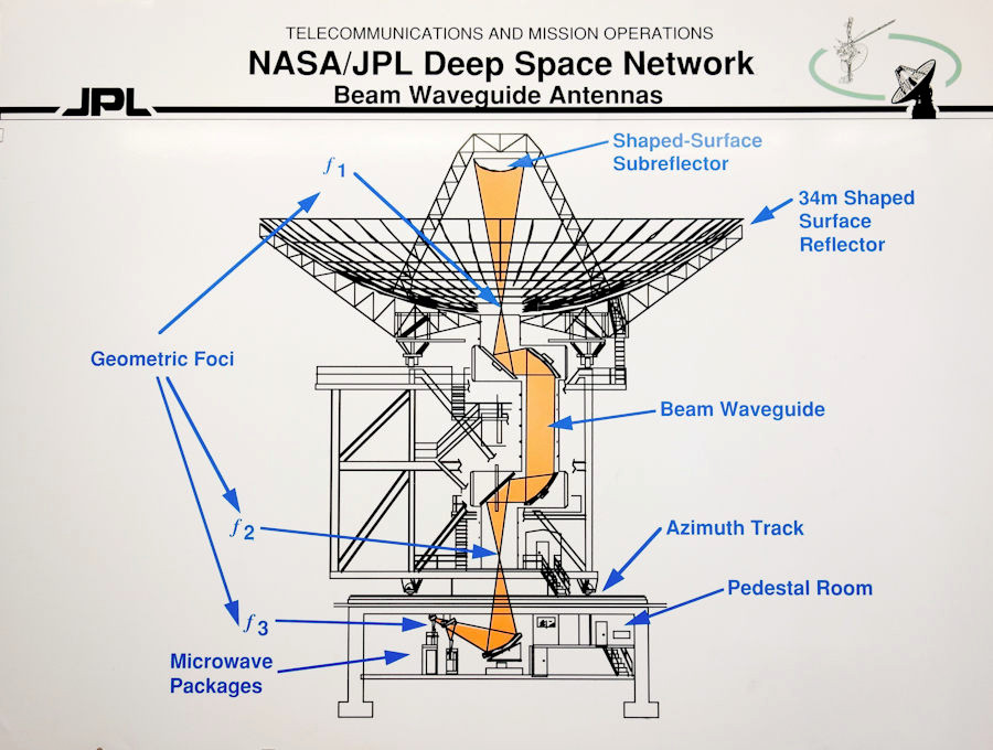
Between 1992 and 1996, NASA erected three new 111.5-foot Beam Waveguide antennas in the Apollo Valley for deep space communications and research, which became DSS 24, 25, and 26, known collectively as the Beam Waveguide Cluster. “This design uses five precision radio frequency mirrors to reflect radio signals along a beam-waveguide tube from the vertex of the antenna to the equipment room in the pedestal located below ground,” according to NASA. By moving “weather-sensitive electronic equipment underground” this “pedestal allows for easier repair, maintenance, and upgrades.”
The very last of the sites at Goldstone, known as DSS 27 and 28, and collectively as the Gemini Constellation, were originally built for the Army, but came under the control of NASA in 1994. These sites both have 111.5-foot Beam Waveguide antennas similar to those in the Apollo Valley. Initially, these antennas supported the Solar Heliospheric Observatory (SOHO) program, which NASA conducted with the European Space Agency. Today, DSS 27 is part of the Deep Space Network, while DSS 28 has taken on a purely educational role as part of the Goldstone Apple Valley Radio Telescope (GVART) project. GVART focuses on cultivating interest in radio astronomy among grade school and high school students.

Today, DSS 11, 12, 15, 16, 17, and 27 are all inactive. Buildings at DSS 12 now house administrative offices. DSS 13 has been repurposed for research and development activities. DSS 14, 24, 25, and 26 all continue to support NASA’s Deep Space Network mission. The complex still helps track dozens of spacecraft across the solar system, including the various Mars rover missions. You can find a full list of the programs it presently supports here.
Goldstone Airport’s NASA years
Throughout all of the expansions and additions at the Goldstone Deep Space Communications Complex (GDSCC), Goldstone Airport offered a valuable way for Jet Propulsion Laboratory (JPL) personnel and contractors to make both routine and emergency trips to the remote complex. Since its founding in 1936, the official address of JPL’s headquarters has been in Pasadena, California, though the bulk of its main campus is now technically inside the limits of the city of La Cañada Flintridge.
The straight distance between JPL and GDSCC, which lies to the northeast, is around 110 miles, but the actual distance by ground transport, at least as of 1977, was approximately 175 miles. The distance between Burbank Airport, where NASA staged many of the flights, and Goldstone Airport is around 115 miles.
In its 1978 Fiscal Year budget request, NASA asked for $150,000 to extend the runway at Goldstone airport from 4,760 feet to 6,000 feet and widen it from 60 feet to 100 feet to better support these activities. Paved turnarounds and a small ramp at the north end of the runway were also part of the request, which Congress ultimately approved.
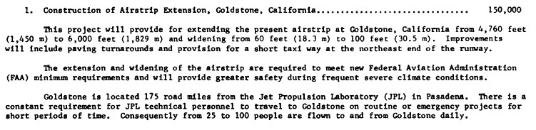
“There is a constant requirement for JPL technical personnel to travel to Goldstone on routine or emergency projects for short periods of time,” an official budget document explained. “Consequently from 25 to 100 people are flown to and from Goldstone Daily.”
These upgrades brought the runway at Goldstone to its present dimensions. They remained the extent of major improvements there for decades.
Transfer to the Army
It’s not entirely clear when NASA officially transferred control of Goldstone Airport to the Army. As of 2005, it was still using it for flights to the GDSCC.
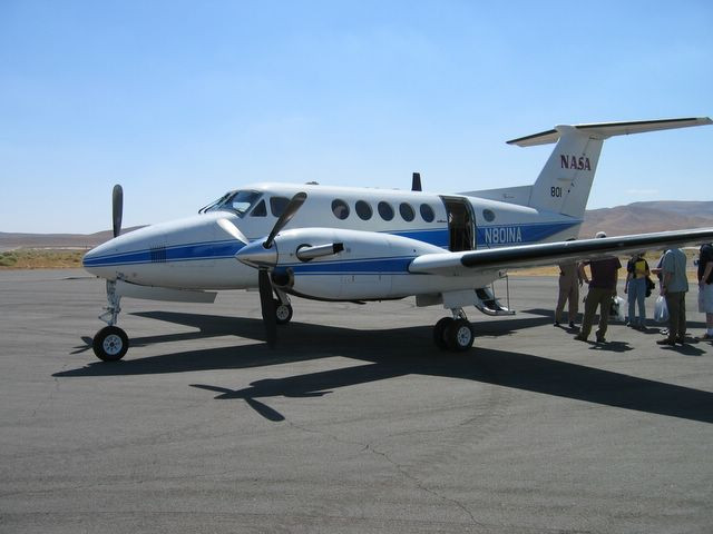
David Acton, a Ball Aerospace engineer who worked on the Deep Impact mission, which sent a probe to study the comet Tempel 1 that year, arranged for a tour of the complex for himself and a number of others. A NASA Beechcraft King Air flew them to Goldstone from Burbank.
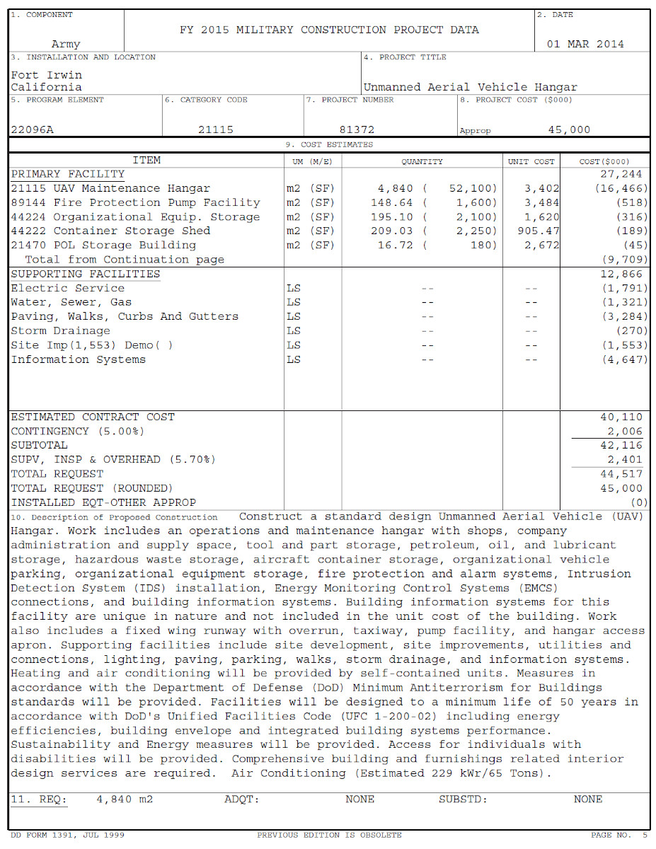
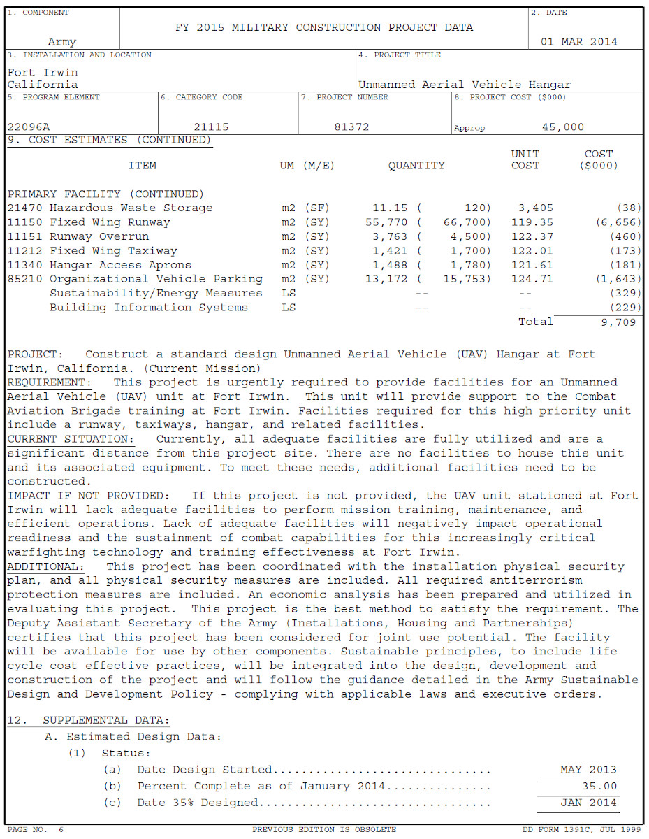
However, in October 2014, the Army activated Company B, 229th Aviation Regiment at Goldstone Airport, marking the beginning of the drone training mission there. Early that same year, in its budget request for the upcoming 2015 Fiscal Year, the service asked for $45 million to build the new 52,100-square-foot hangar and associated infrastructure for Company B. The unit originally operated out of temporary structures.
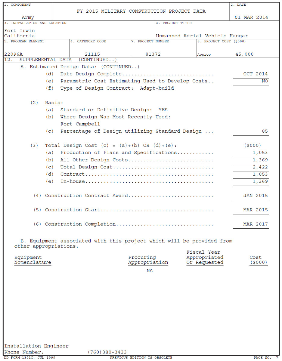
Despite its training focus, Company B actually deployed for combat operations in Afghanistan in support of the U.S.-led coalition there in late 2015, with the idea that it would take up residence at the new facilities at Goldstone when it returned. The Army broke ground on the hangar and associated construction in January 2016.
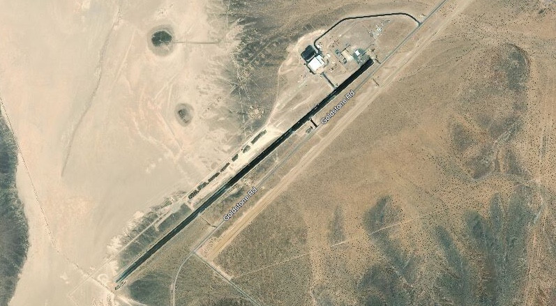
One can see in the recent satellite imagery of Goldstone that the runway is marked “UAS,” the abbreviation for “Unmanned Aircraft Systems.” This would indicate that it is only approved now for use by unmanned aircraft, which could preclude any further fixed-wing shuttle flights to the airport by the Army, NASA, or anyone else without some sort of prior approval and coordination. Helicopters could still potentially fly to and from the airport.
With its new facilities at Goldstone Airport, Company B continues to fly training missions in support of activities at the nearby National Training Center. The airstrip is an ideal location for drone operations due to its remote location, combined with the general nature of the rest of GDSCC, which significantly reduces the amount of potential outside signal interference. This is one of the reasons why JPL decided to construct its space communications systems and radio telescopes in this area in the first place.
Company B has also remained available for operational deployments, as necessary. In November 2017, the unit deployed to Iraq supporting the U.S.-led coalition fighting ISIS.
Goldstone’s isolated location could also make a good place for testing more sensitive upgrades for the Gray Eagle or new, advanced unmanned platforms. In addition to its primary mission as a training facility, the NTC also supports various test and evaluation activities.
With its space race origins, Goldstone Airport and the rest of the Goldstone Deep Space Communications Complex has had a fascinating history already. That lineage has taken a new twist with the Army moving in and creating a key drone base out of the once very basic airstrip. The little remote base now looks set for years of further use supporting Army drone activities at the nearby National Training Center.
Contact the author: joe@thedrive.com and tyler@thedrive.com
Loading comments…
Comments couldn’t be loaded. Please refresh the page.