The U.S. Navy recently conducted successful flight tests of a UAV carrying an aerial laser system designed to map the ocean floor in shallow water areas. While details are scarce, we know that the tests used a Light Detection and Ranging, or LIDAR, system aboard a small unmanned helicopter. While such a system could be an important tool for making detailed topographic maps of waterways and littoral areas, there could be other potential applications of well beyond general cartographic ones.
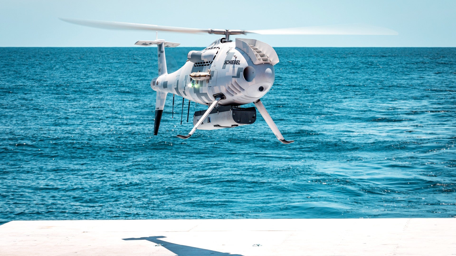
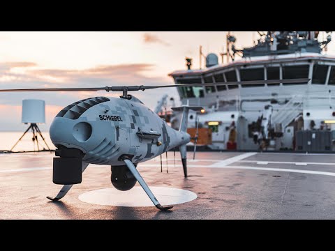
The tests were conducted by the U.S. Navy’s Office of Naval Research (ONR) in conjunction with Shiebel, makers of the CAMCOPTER S-100, the helicopter drone used in the tests. According to NavalNews.com, the tests took place on the commercial vessel Richard L. Becker off the coast of Pensacola, Florida. Hans Georg Schiebel, Chairman of the Schiebel Group, says this his company is proud to showcase the CAMPCOPTER’s capabilities to the Navy in the tests, adding that “we operate extensively on land and at sea and we are confident that our unmanned solution is also the right fit for the US Navy.”

The LIDAR system used in the demonstration is the Pushbroom Imaging Lidar for Littoral Surveillance, or PILLS, made by defense contractor Areté. LIDAR is a low-power, eye-safe laser technology that measures the light reflected from short pulses in order to quickly and accurately make 3D maps of an environment. LIDAR systems are used in a wide variety of applications including surveying, laser guidance systems, and even in some self-driving cars.
As early as 2000, the Naval Oceanographic Office was exploring airborne LIDAR for conducting surveys of underwater topography. More specifically, the Navy has been exploring using the PILLS LIDAR system aboard unmanned aerial systems for making seafloor maps since at least 2016, according to an ONR release. The service also conducted exercises in the Mississippi Sound in 2019 that featured “two unmanned aerial system-capable” LIDAR systems. As ONR’s release states, the capabilities offered by the PILLS system are needed because “remote areas around the world lack precise or updated topographic maps or bathymetric charts.”

One of the principal downsides of using LIDAR for mapping underwater topography is the fact that a significant amount of a laser’s energy is lost in water due to refraction, scattering, and absorption. These effects can limit the depth at which measurements can be accurately made, as can water clarity.
Despite these limitations, the Navy awarded Areté a Phase II Small Business Innovation Research (SBIR) contract in 2016 worth $1.4 million that would take the PILLS LIDAR and “adapt this existing system with an upgraded compact laser and perform the necessary development to operate the system in a high vibration and shock environment associated with ship launched and recovery unmanned aerial vehicles.”

The unmanned aerial system chosen for this latest test of the PILLS system, the CAMCOPTER S-100, is a vertical takeoff and landing (VTOL) UAV featuring a standard helicopter configuration. CAMCOPTER S-100 arrived on the unmanned aircraft scene a decade and a half ago and has been evolving ever since. According to its manufacturer Schiebel, the unmanned platform can operate without a “prepared area or supporting launch or recovery equipment” and is capable of both day and night operation in any type of weather. Schiebel claims a beyond-line-of-sight range of around 125 miles over sea or land and a ten-hour endurance. The mini helo is highly transportable and can be operated in nearly any environment.

Schiebel also says the CAMCOPTER can carry payloads up to 75 lbs, has a flight ceiling of 18,000 feet, and can be fueled with either aviation gasoline or kerosene-type jet fuel. The UAV is even claimed to be capable of operating in GPS-contested environments “with missions planned and controlled via a simple point-and-click graphical user interface.” The 10-foot helicopter has previously been used by the French Navy, among a growing list of other international customers, as well as for applications in the United States. In addition to LIDAR systems, the platform can carry a wide variety of sensors and communications gear, loudspeakers, or droppable cargo containers. Above all else, it has a proven pedigree as an optical and infrared surveillance platform.

By using small UAVs to conduct LIDAR mapping of the ocean floor, the Navy could offer a new type of surveillance in addition to simply making more detailed oceanographic maps. If Areté and the Navy manage to develop an aerial LIDAR system capable of efficient and consistent underwater modeling, the potential applications could be wide-ranging. The CAMCOPTER’s ability to take off and land from unprepared areas means it could be well-suited to expeditionary operations using a forward arming and refueling point (FARP) or even just an open deck area on ships. The unmanned helicopters could be used to surveil areas around the numerous small islands of the highly contested Pacific, for example, using their LIDAR systems to scout for undersea sensors, small unmanned underwater vehicles, or naval mines. In a special operations application, they could provide very up-to-date intelligence on the littorals around target areas prior to swimmer insertions. The same could be said for preparing and scouting for larger amphibious operations.
It will be interesting to see if this concept gets adopted to a wider degree, but considering the maritime challenges facing the U.S. military, it shouldn’t be a surprise if it does.
Contact the author: Brett@TheDrive.com
Loading comments…
Comments couldn’t be loaded. Please refresh the page.