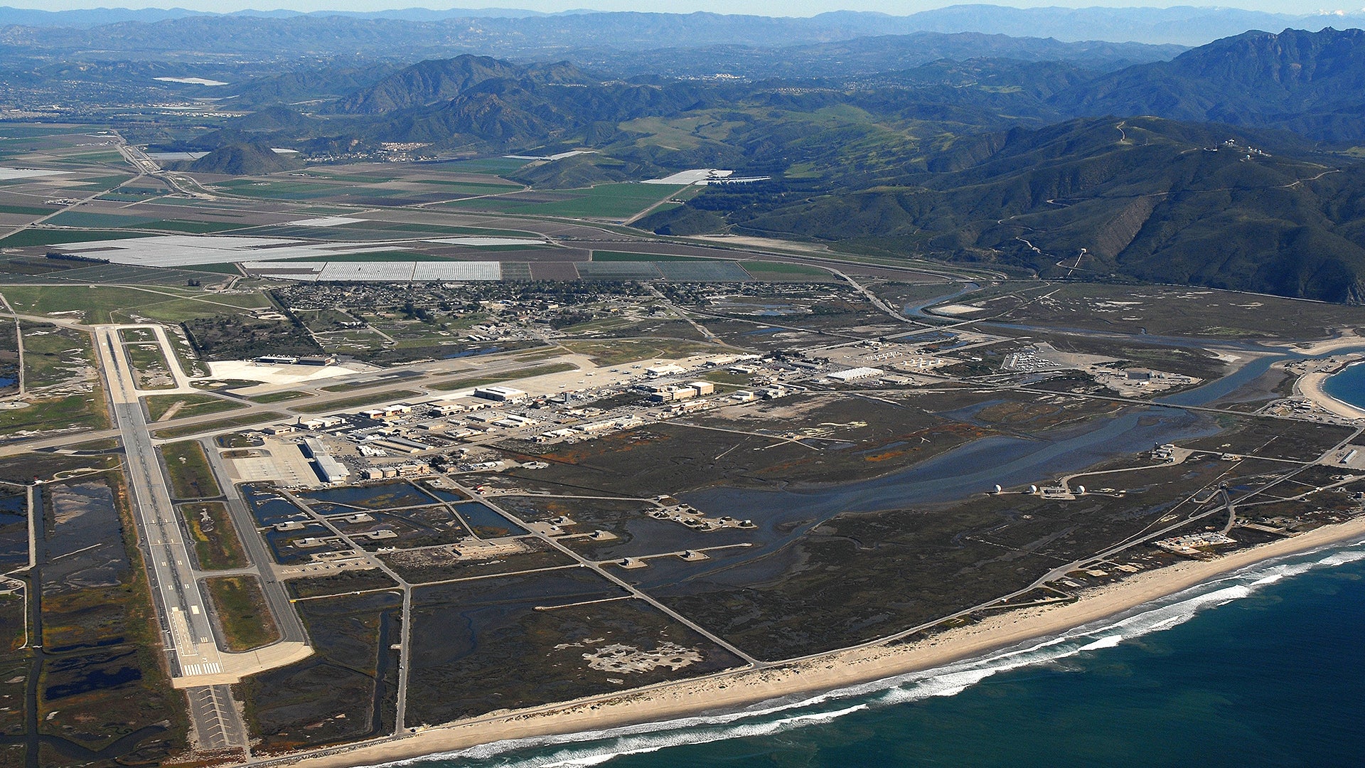
Now called the Hill Fire, the Southern California blaze broke out at 2pm on Thursday and has so far scorched 10,000 acres as it makes its way toward the Navy’s sprawling air base located along the coast near Camarillo, California. An optional evacuation notice has turned into a mandatory one this evening as the commander that has purview over Naval Air Station Point Magu saw no other choice but to get his people to safety in case the fire, which has been whipped up by high winds, blitzes into the installation. Even more pressing is the status of an important radar telemetry and communications station on nearby Laguna Peak. This facility provides surveillance and support for Point Mugu Range Complex and SOCAL Range Comlex activities and also does critical space tracking work.
As of 7pm local time, the tweet below shows the evacuation areas which includes Laguna Peak and butts up nearly against NAS Point Magu:
Just an hour later, the commander at the naval air station ordered a full evacuated. Here is the tweet:
VLAT tankers were working the area into the early evening but high winds have made the fire very tough to contain in any meaningful way.
Laguna Peak, which looks over the air base, seems at great high risk here—that is if it is still intact. As of 8pm, the facility was given high priority and water tenders were moving up the hill to help keep the flames at bay as the water tanks on site were empty.


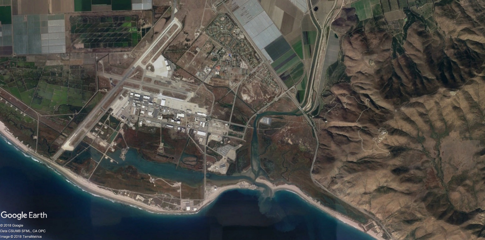
As you can see in the satellite image above, just below Laguna Peak is NAS Point Mugu. The road you are seeing bisect the two is Highway 1 (CA1). If the flames jump it and the narrow wetland/inlet, the base could be set on fire.
NAS Point Mugu, which is part of Naval Base Ventura County, is really the heart of over-water range operations off the Sothern California coast and serves as a headquarters for a lot of the testing and training that happens around the Channel Islands, in particular. It’s also the home of the West Coast E-2C/D Hawkeye community and Navy Test And Evaluation Squadron 30 (VX-30). The California Air National Guard’s C-130Js also call the installation home and the Navy’s new MQ-4 Tritons drones are housed there as well. The aerial targets group, that launches and recovers target drones, runs their operations out Point Mugu too. Also, the Airborne Tactical Advantage Company (ATAC) also has a long-standing aggressor detachment at the base that you can read all about in this past magazine feature of mine. These are just some of the base’s primary residents, so suffice to say that the installation is very important and valuable to the U.S. Navy.
Hopefully, the fire will stay on the inland side of Highway 1 and away from the radar station as well and none of this ends up being an issue, but as of right now the situation looks quite concerning.
Update: 10:55am PST—
Finally have a good picture, taken an hour ago, of the situation in the vicinity of Point Mugu and Laguna Peak. Look at this:
The fire appears to be right next to Laguna Peak and creeping down the northwest side of the mountain towards NAS Point Mugu.
The evacuation order is still in place for the naval air station:
Hopefully, they can get some tankers in there to lay down some additional slurry to stop the fire’s advance, especially for Laguna Peak.
We will update this post as more information comes available.
Edit note: changed name from Highway 101 to Highway 1.
Contact the author: Tyler@thedrive.com
