With all the technology at our fingertips today, the very idea of celestial navigation remains a romantic and even a bit bewildering one. It harkens back to a time when mankind had a much richer connection with the heavens above. But the truth is the task of navigating by the stars became increasingly automated and miniaturized as a necessity of the Cold War. The advent of the Global Position System (GPS) and the diminished threat of all-out nuclear armageddon left advanced celestial navigation capabilities for a small number of weapon systems and the history books. But now, with the possibility of having to fight in a combat environment where GPS and all its benefits are denied, updated automated “astro-nav” capabilities may represent one of the best and most proven ways of overcoming this challenge.
Addicted to GPS
Suffice to say that beginning in Operation Desert Storm, America’s military might has become increasingly dependent on a stable and highly accurate GPS system. Everything from ballistic missile submarines to formations of armor use this service to leverage instant geo-locating abilities, as do the majority of guided munitions, and especially those that are fired from standoff ranges.

Combat aircraft and fighting ships largely navigate using inertial navigation systems (INS) with embedded GPS. You can read all about these amazing pieces of technology here. Inertial navigation systems have gyros that are capable of sensing inertia and orientation and work as something of a self-contained dead-reckoning apparatus. They alone are capable of getting an aircraft or ship into the general area it needs to be, but over space and time their positioning accuracy degrades. In other words, the longer a vehicle navigates on INS alone, the more inaccurate their actual position will be.
These systems are especially susceptible to drift if they don’t get periodic “updates” from another navigational source, such as GPS or radio navigation aids. INS with embedded GPS systems aren’t just found on large military vehicles either, they are also used on munitions as lowly as the Joint Direct Attack Munition (JDAM) and even guided artillery shells.
INS with embedded GPS works as sort of a voting set of systems that use software algorithms or filters to collectively best decide upon the aircraft’s position based on the data at hand. If one source begins to stray heavily or shows signs of malfunction, software can discount it and rely more heavily on the other. GPS spoofing, where the GPS signal is replaced with a fake one, is one electronic warfare tactic that is becoming alarming common, with Russia using it during training and other mysterious scenarios in the recent past.
Advanced and highly targeted GPS spoofing attacks could theoretically be especially insidious as the fake signal could provide data that slowly changes a vehicle’s true location over time, making the anomaly far less noticeable to human operators or to a GPS/INS navigation systems of software logic.
These more localized and targeted GPS tampering tactics are one thing, but denying GPS over a small or broad area altogether is even more concerning, and this is a threat that is growing in size and complexity, with Russia indicating they would leverage it to gain an asymmetric advantage during a time of war.

Electronic and cyber warfare are the likely avenues of such an attack, but anti-satellite weaponry that can disable, jam, or even destroy satellite navigation capabilities at the source are a more troubling tactical possibility to factor in when facing off against a capable peer-state foe. But lower-end jamming and cyber attack capabilities targeting GPS aren’t just relegated to traditional foes. Non-state actors will be increasingly capable of waging war on this level as well.
With all this in mind, GPS vulnerability has become a far more pressing strategic issue as of late and the Pentagon is scrambling to find new ways—or even old ways—of negating the impact of these types of enemy operations. One potential antidote for the issue, at least for some systems and platforms, may include reviving and modernizing a truly “back to the future” concept—automated celestial navigation, also referred to as “astro-nav.”
From sextants to R2-D2
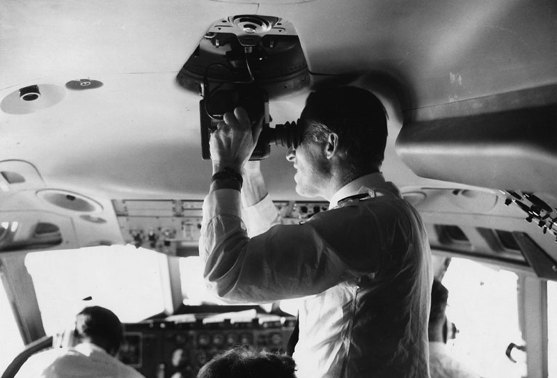
Decades before the advent of GPS, manual celestial navigation remained a skill used in both the maritime environment and in the skies. Even fairly modern aircraft were designed with this form of navigation in mind. For instance, the 747 was designed with a sextant port, and the VC-10 and 737 were designed with a sextant periscope. But even this secondary navigation aid became obsolete as radio navigational systems became far more prevalent and accurate.
Like so many key technologies we enjoy today, automated astro-navigation was introduced as a necessity of the Cold War. With the advent of weapons capable of traveling vast distances at high speed, there had to be a way to automatically correct for the inaccuracies that were intrinsic to inertial navigation systems. This problem gave birth to the astro-inertial navigation system (ANS).
An absolutely cutting-edge system at the time of its conception, it was capable of automatically cross-checking a vehicle’s position as defined by its INS with that defined by its relation to the stars. This drastically improved the overall system’s accuracy and was able to correct for drift-related errors intrinsic to INS. This capability was first introduced on the SM-62 Snark cruise missile. The Snark was America’s precursor to the age of nuclear-tipped ballistic missiles.

Initially, in 1957, the Snark showed that it had a circular error probability, also known as CEP (where the missile would impact in relation to its target), of 17 miles after flying thousands of miles downrange at high subsonic speeds to its target area. Even for a high-yield nuclear delivery system this was unacceptable. By 1958 the ANS system was installed and its CPE shrunk to four miles—an amazing accomplishment considering the technology of the era.
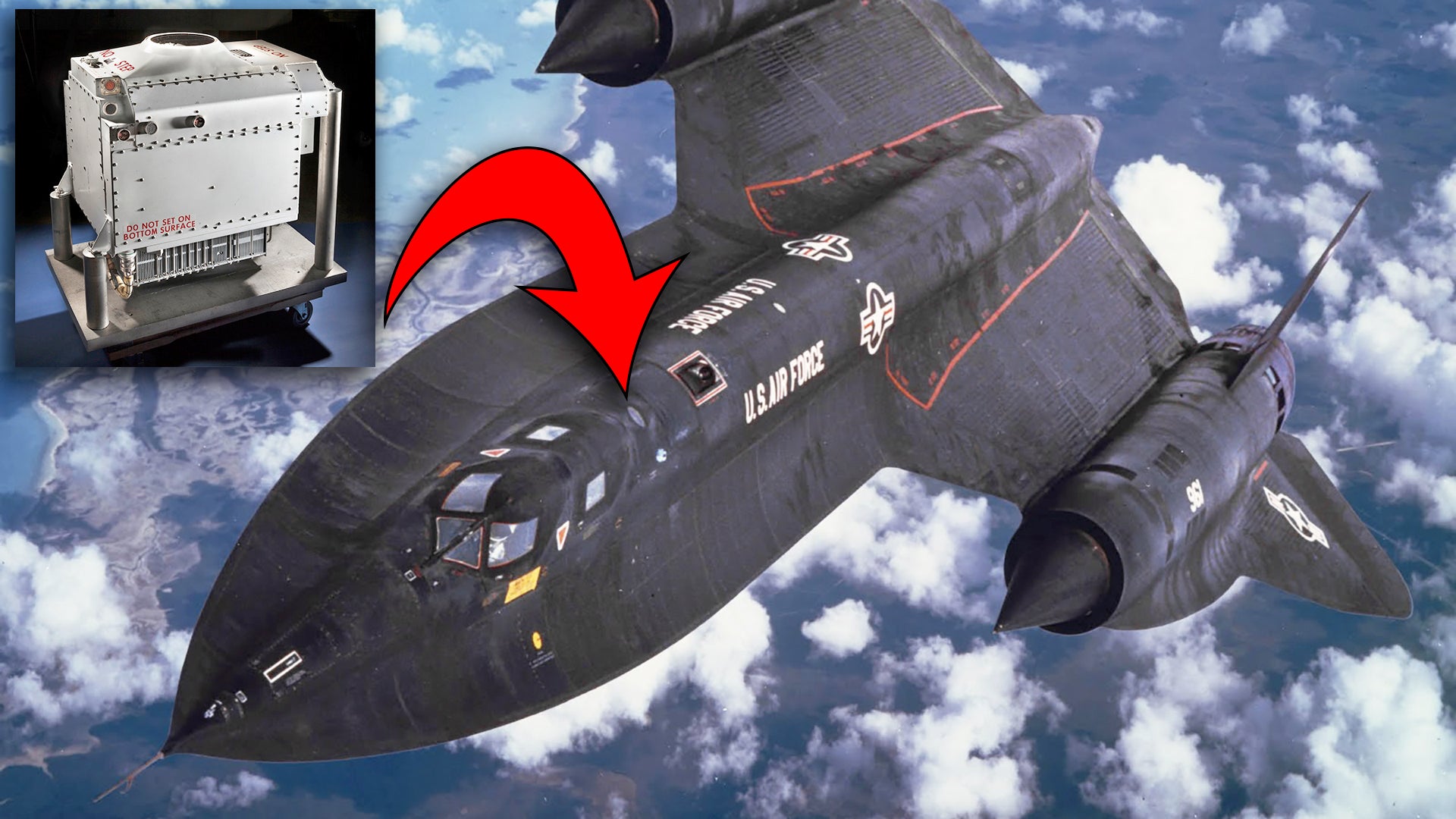
The concept was drastically refined over the following years and AIN units found themselves on high-end platforms, including virtually all U.S. ICBMs to this very day, and one of the most incredible engineering accomplishments of all time—the SR-71 Blackbird.
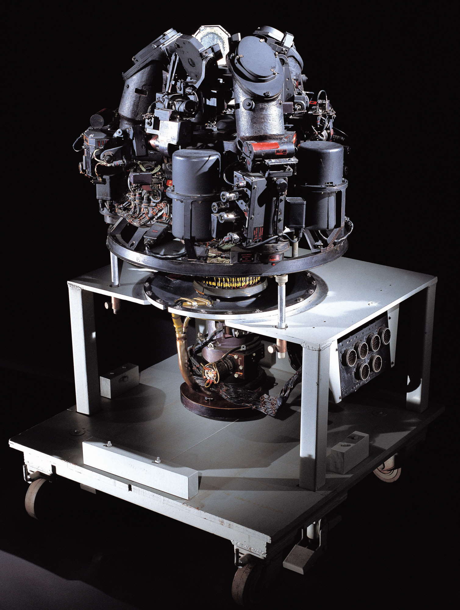
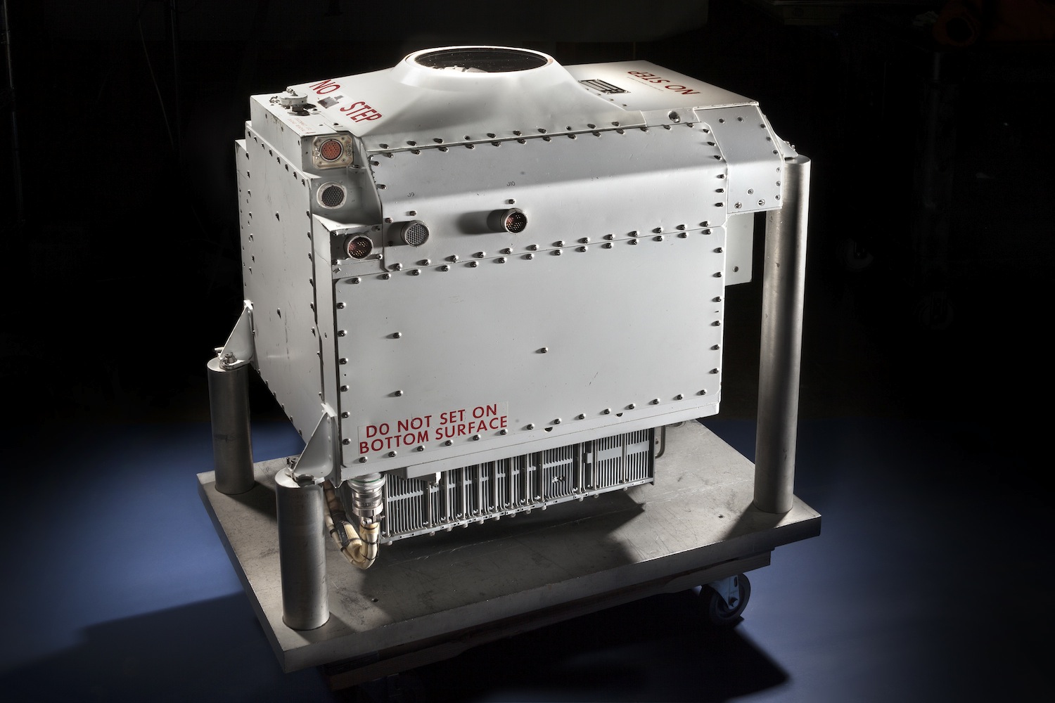
Because of the SR-71’s speed, proximity to very hostile countries, and the need to automate its reconnaissance sensors, not to mention the nature of its critical mission set, having highly accurate navigation that didn’t tax the crew’s resources unnecessarily was absolutely essential. The Nortronics NAS-14V2 astro-inertial navigation system provided this functionality for the Skunk Works’ mach three spy plane.
The crate-sized guidance group, with the ANS on top, was dropped into the jet’s spine before missions. This system was eventually known by Blackbird crews, mission planners, and maintainers as “R2-D2,” and its job wasn’t that far from that of its famed Star Wars astromech droid namesake.
In a previous post featuring an incredible hands-on video tour of the Blackbird’s cockpits, SR-71 pilot Richard Graham also describes the jet’s astro-inertial navigation system in detail along with other recollections about operating the famous jet. The video is reposted below and the relevant part about the jet’s guidance group begins just at 53 minutes. It is an absolute must watch:

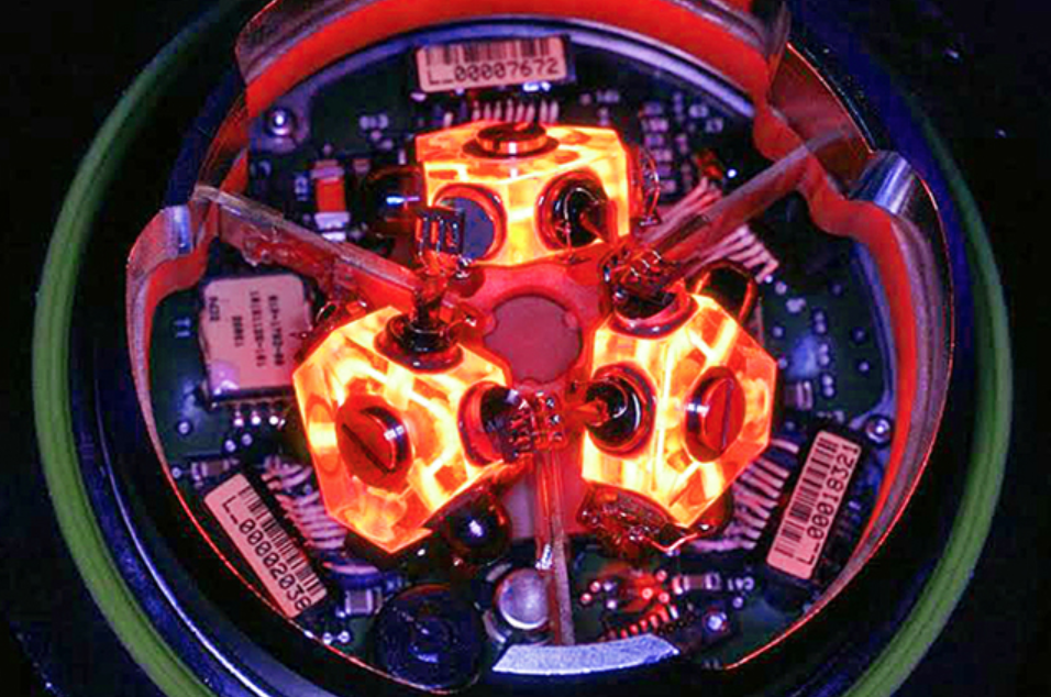
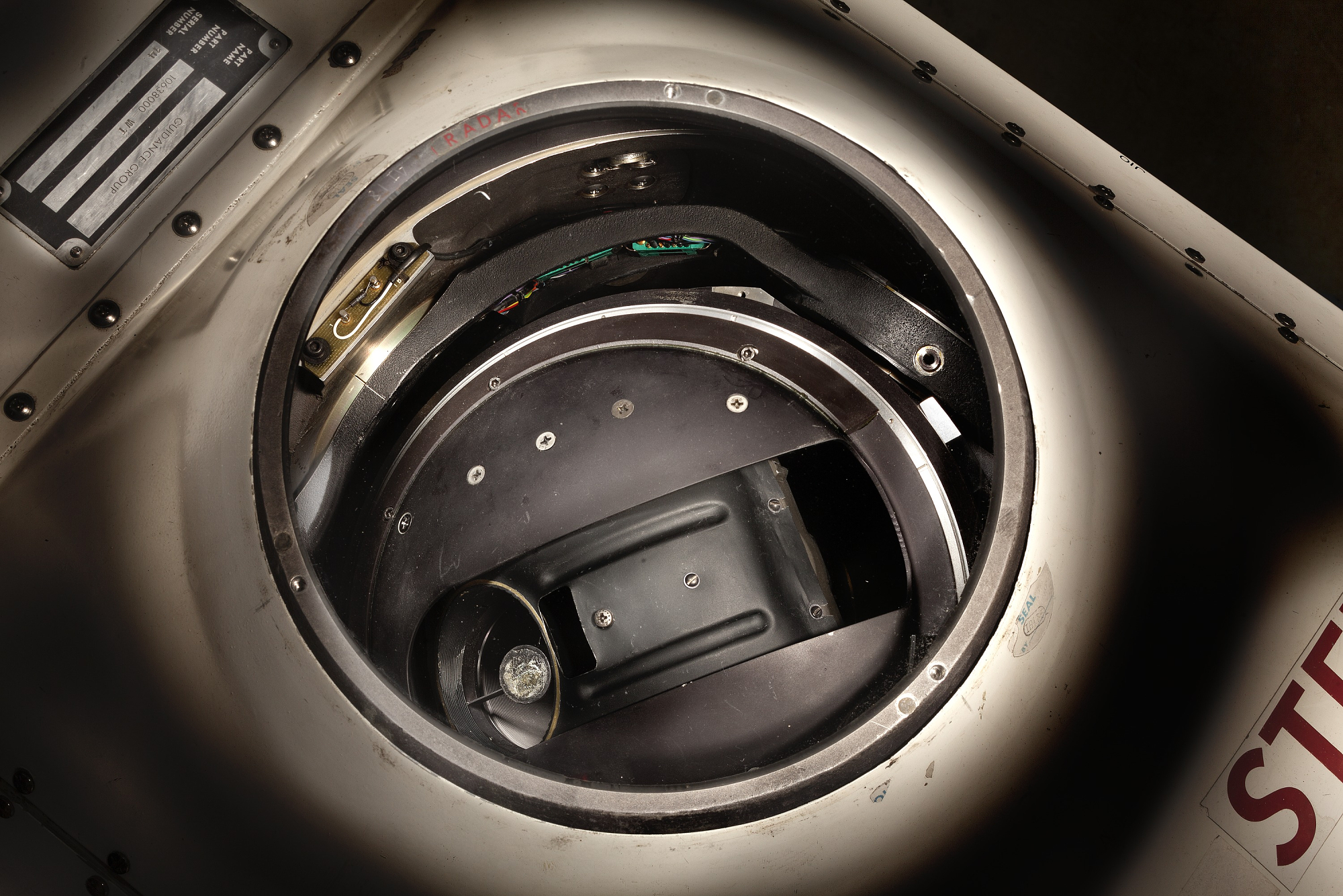
Graham describes how all of the Blackbird’s sensors and navigation systems are automated by the guidance group, and the entire mission is pre-programmed into this system and the mission is tested on the ground before flight. The astro-nav’s gimbaled telescope-like system on top of the guidance group works by making an ever-widening circular search pattern to find and fix three of any of 64 mapped stars in its memory, and compares their locations to a Julian calendar and a highly accurate chronometer. And from this it provides a precise position as the jet sits on the ground or as it hurtles through the air at 80,000 feet and mach three. And all of the SR-71’s sensors are automatically programmed to take images, both optical and radar, based on where the aircraft is in time and space during its mission as defined by the astro-nav.

Graham goes on to make the point that really, the system isn’t that different than GPS that we use today. Instead of using a constellation of chronometer-packing satellites in orbit around the earth, the astro-nav uses the light from distant stars and its own chronometer to figure out its location.
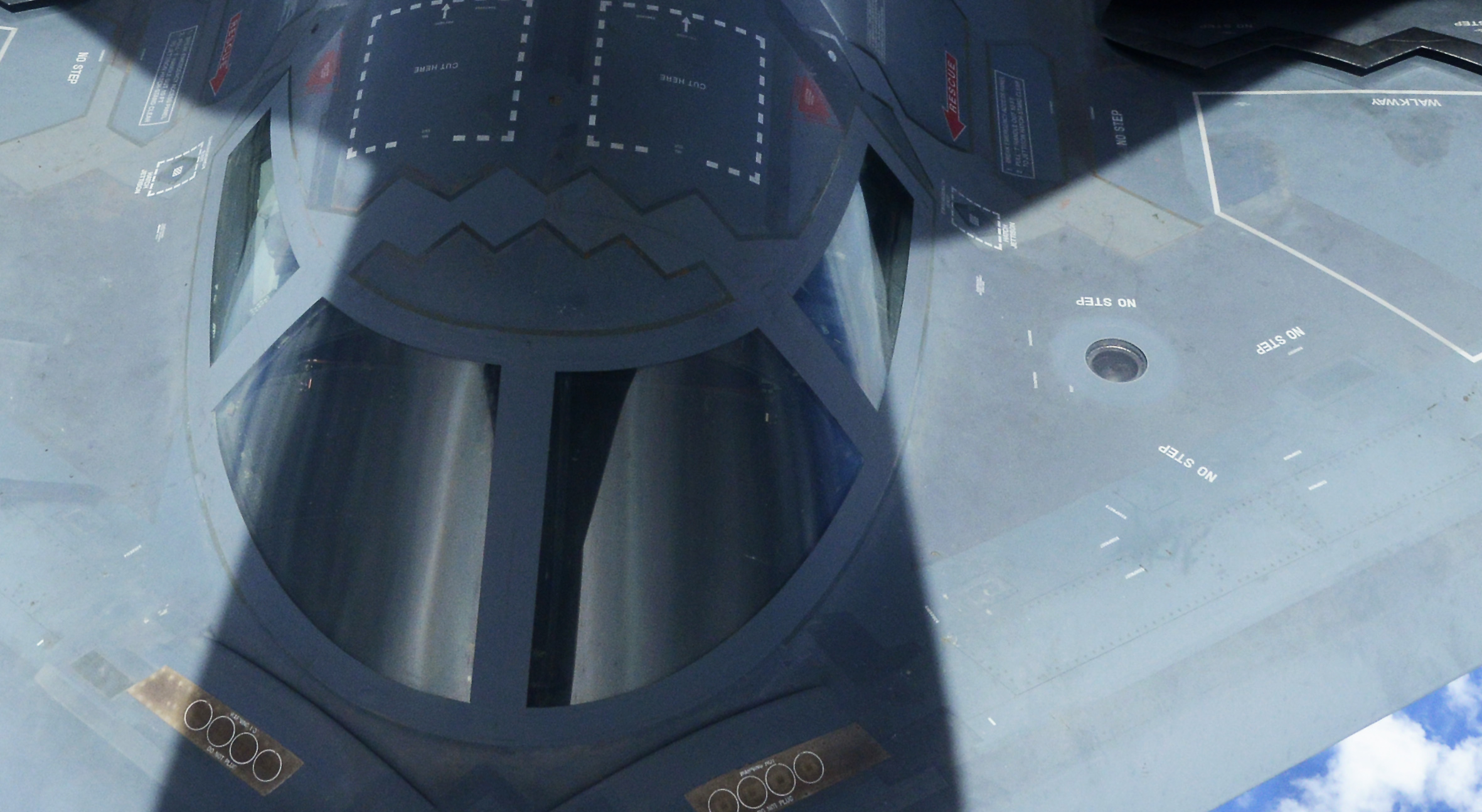
Evolved variations of the NAS-14V2 found themselves on other strategic aircraft as well, most notably the B-2 Spirit stealth bomber. The system is flush mounted to the left of the cockpit near the B-2’s intake. You can clearly see the plate-sized quartz glass window that covers the astro-tracker’s gimbaled telescope in aerial refueling photos like the one below. Other astro-nav systems, like Lockheed’s AST-201, are also used on satellites so that they can independently orient themselves.
Another more advanced system was designed for the B-1B, called the ANS-26, which had a different configuration than that of the NAS-14, but even during the waning days of SR-71 Blackbird operations, the system combined with INS was supposedly able to put the aircraft within roughly a 300 foot box in space and time.
Bringing automatic celestial navigation into the future
New astro-trackers use a far less mechanically complex systems to provide astro-tracking, such as those that get rid of the gimbaled telescope and use a very wide angle staring sensor array in its place. This technology has actually been around since the end of the Cold War in the form of systems like Northrop’s Optical Wide-angle Lens Startracker (OWLS), which uses a holographic lens and a sensor system that is far more sensitive and thus more capable of detecting stars.
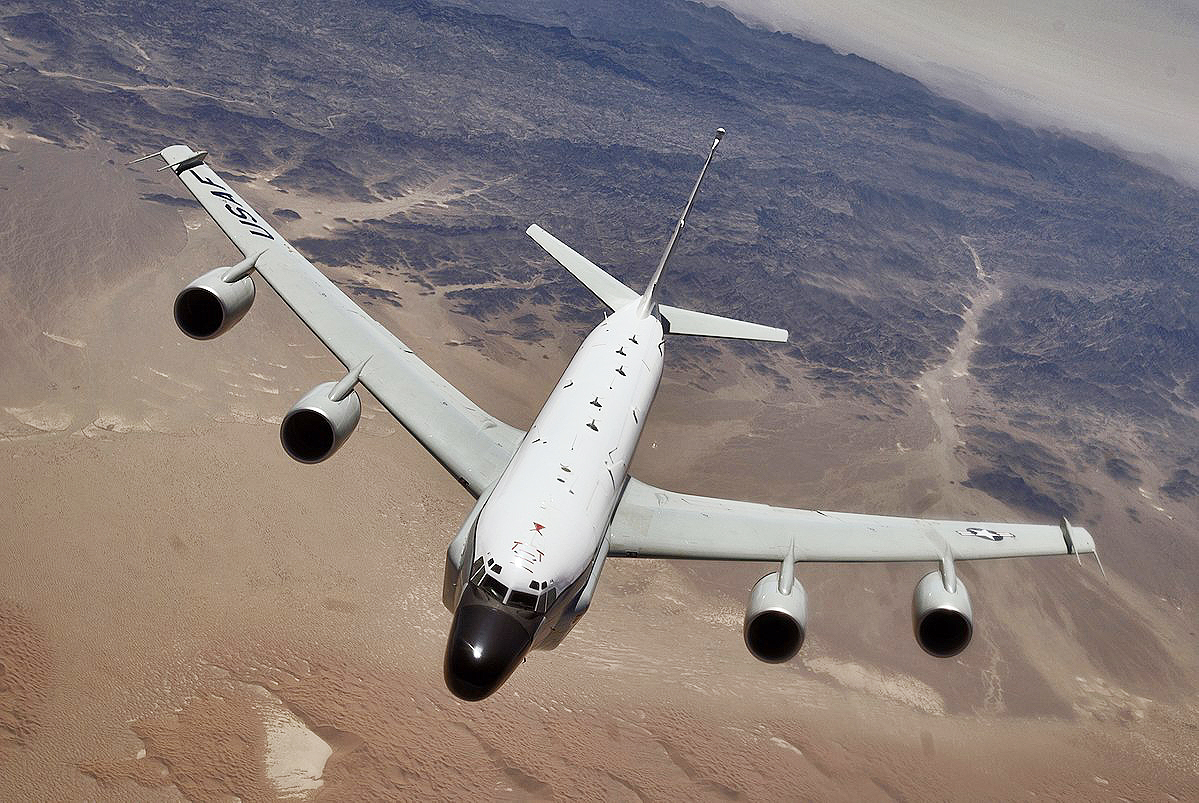
More recently Northrop Grumman has fielded its LN-120G Stellar-Inertial-GPS navigation system that is used on RC-135 surveillance aircraft. This relatively compact system integrates a modern INS system with GPS and astro-tracking, giving a triple redundant capability and positive performance even in GPS-spoofing or GPS-denied environments. Considering where these aircraft operate—near the borders of potentially hostile countries—it is a very good capability to have.
Today, this type of capability could be miniaturized even further, possibly into a shoebox-sized array and computing system, one that uses multiple staring CCD arrays to continuously scan the entire sky at one time. Such a system could be flush mounted into combat aircraft or possibly carried in a podthat protrudes from under a tactical aircraft’s wing.
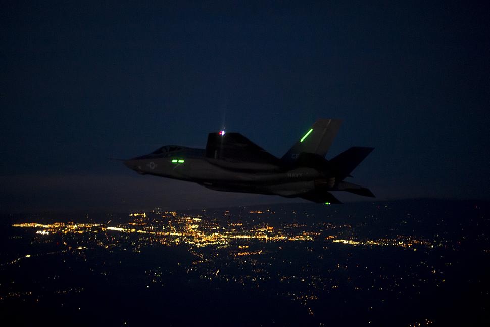
Even something like the F-35’s Distributed Aperture System (DAS) may be capable, or at least adaptable, to providing highly precise celestial navigation running as something of a “background app” on top of the system’s other tactical functions. And instead of having 64 stars in its memory banks it could have thousands, and may be able to drastically reduce the margin of inaccuracy of earlier systems.
Regardless of the exact configuration of a modern airborne celestial navigation system, such a capability could largely overcome the loss of GPS. It may even be possible to create a “virtual GPS” system by using high-flying aircraft with astro-navigation and other GPS denied technologies installed onboard to support tactical platforms operating below. Such a concept could allow for a semi-centralized GPS replacement approach and would theoretically be able to not just provide navigation for aircraft but also for their weaponry, at least over a finite period of time and geographic area. In other words, only these high-flying aircraft would require unique systems like astro-nav, but all the allied aircraft and weaponry in their immediate combat environment would benefit from them in a similar fashion to how GPS functions today.
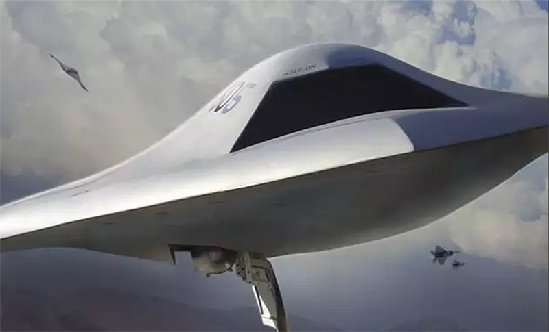
For instance, a trio of high-altitude, long-endurance (HALE) stealthy drones, such as the shadowy RQ-180, or even high-flying B-21 bombers, could penetrate into enemy airspace prior to or along with a strike force of tactical aircraft, cruise missiles, and air-launched decoys. These HALE platforms would use automatic celestial navigation systems and well as other advanced GPS denied navigation tactics, to establish a very accurate position at all times and then they could data-link this information to the tactical platforms and munitions below.
This would allow these assets to come up with highly precise positioning in time and space. Basically, this is a temporary and survivable GPS network. And because it isn’t persistent, it would be much harder to degrade or outright jam. If it could use proprietary data-links, especially the directional kind such as the F-35’s MADL, instead of an omni-directional GPS-like or Link 16 signal, it could be even more survivable.
For the future, unmanned combat air vehicle swarms could leverage celestial navigation and would also be able to do so in a cheaper “distributed” manner. Not all UCAVs in a swarm would need such a system, say just one per division, or sub-swarm, of say between six and a dozen aircraft. That aircraft can provide positioning updates to other UCAVs in their division. If that UCAV were lost or had a mission abort, that division could simply joint another with a functioning astro-nav carrying unit. Benefits and increased accuracy could also likely be realized by networking multiple astro-nav equipped drones together over a large area.
Pairing this capability with other capabilities, like miniaturized atomic clocks and/or BAE’s Navigation Via Signals of Opportunity (NAVSOP), which uses existing electromagnetic radiation in the environment, like cell phone tower and television signals, or even the emissions from GPS jammers themselves, to provide positioning information, or onboard atomic clocks, or radar imagery matching concepts, could result in highly reliable and redundant automated navigational capabilities without the need for space-based assistance.

The bottom line here is that we know by experience that celestial navigation, the oldest form of navigation really, works very well in an automated form, and considering how far technology has come since the end of the Cold War, especially in terms of automation and sensors, the astro-nav concept is likely ready for a massive breakthrough in miniaturization and accuracy. In doing so, it could give the U.S. a decisive edge in future high-end combat scenarios, and some of those scenarios may include U.S. forces jamming GPS around themselves on their own accord.
Years ago I predicted that small hobbyist-like drones would become the scourge of the modern battlefield as well as the terrorist assassins of the future. Sadly, reality has arrived, and a future where swarms of small drones will be a mainstream military capability for which there is little established kinetic defense against is now on the horizon. But the Achilles heal of this concept is that small and cheap drones rely entirely on GPS navigation. So denying GPS around friendly troop emplacements, vessels, airstrips, and other critical infrastructure could be the only realistic defense against it. In other words, having the ability to “turn off” GPS by whatever means without it having a major impact on your own military operations could be a massive strategic advantage in future conflicts.
Time for an astro-navigation 2.0
An astro-navigation renaissance is already underway in the U.S. Navy, which is teaching ancient skills to its sailors once again due to the threat of losing GPS capabilities. And there are increasing calls to field new automated astro-nav systems on vessels to augment, and in the case of war, even take the place of GPS in their integrated navigational suites. Don’t be surprised if this technology begins to be assessed by the Army for land combat uses as well.

Of course there are limitations to these systems as well, and poor weather and battlefield obscurants can drastically curtail their use. But these issues are far less impactful on aircraft, and especially high-flying ones that serve strategic purposes.
In the end reviving this Cold War era concept seems like one of the easiest ways of providing a more resilient combat force capable of taking on future enemy tactics. When these systems are paired with other emerging anti-GPS denial technologies they could provide a potent alternative to GPS to the point that maybe American warfighters would be able to do without the service in order to gain a leg-up on the enemy who doesn’t benefit from such a capability.
Above all else the asto-nav is another reminder that some of the hardest problems facing military planners today could very well be answered using technologies once deemed obsolete. When it comes to celestial navigation, looking “back to the future” may be far easier a proposition that simply looking forward.
Contact the author: Tyler@thedrive.com
Loading comments…
Comments couldn’t be loaded. Please refresh the page.